Map of
Ipswich: 1610
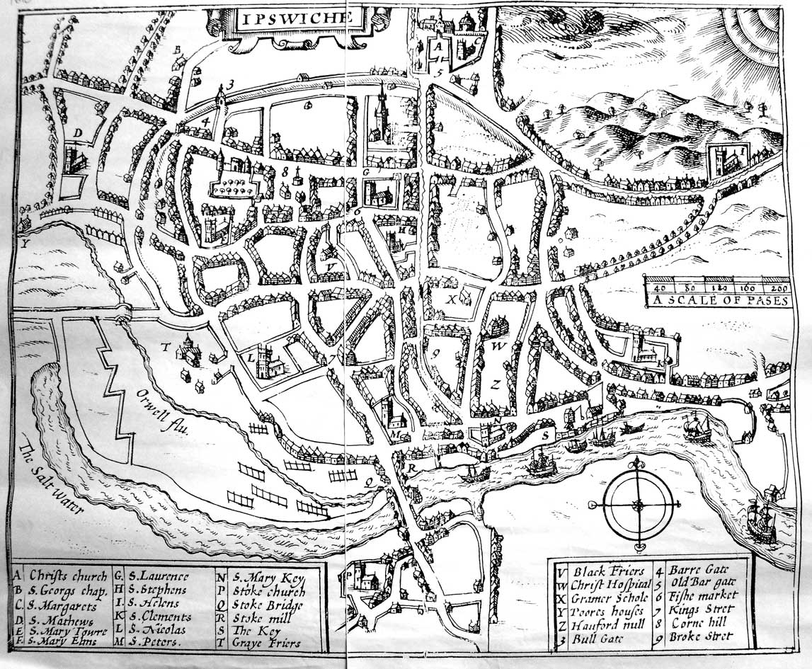
This map is
the work of antiquary John Speed (working
with the Dutch engraver Hondius) and was created as an inset for a map
of Suffolk published in 1610 as part of a series of county maps. See Links
for Stephen Alsford's History of Medieval
Ipswich website with its detailed commentary on features shown on
Speed's map. There are inaccuracies in the map. One is that, in the
legend at the right, 'Z' and 'Y' are reversed. 'Z' should be 'Poores
houses' (i.e. Tooley's Almshouses in Foundation Street) and 'Y' should
be 'Hanford "null" ' (Mill) at the far west of the map.
While Roman Ipswich (c. AD 43 to 450) remains somewhat vague, with
villa remains found at Castle Hill (featured on the Channel 4 series Time Team)
and other archaeological
traces (building materials, pottery and coins) at Handford Bridge, the
subsequent inhabitants have definitely left their mark on the town.
From AD 450 to the 9th century Anglo-Saxon Ipswich (called "The first
town in Anglelond" in Ipswich
Museum
displays) established much of what we now see in the central town plan.
Ipswich was one of the first towns to prosper after the Roman rule
ended. It was also one of the first 'English' towns to prosper under
the
newly arrived Angles. The Angles came from what is now Northern Germany
in the 450s. They built a string of settlements along the Gipping,
which later merged to form a town. The streets in the oldest part of
town still follow the pattern laid down by its Anglian founders. This
was confirmed by archeological digs conducted on the Buttermarket
Shopping Centre site.
Ipswich became a thriving community rich with
specialist craftsmen: a near complete 'Ipswich ware' kiln was
discovered on the dig mentioned by Keith Wade and his team. Trading
ships went back and forth over
the North Sea to what are now German Rhineland and Holland. The Speed
map above shows the line of the rampart-and-ditch defences which ran
from Common Quay on the Wet
Dock, northwards and joining with the line of Fore Street, curving
around the north of the town, past the North
Gate and West Gate and southwards to Friars
Bridge to the west (the Little Gipping River and extensive
marshland define the remainder of the defence down to Stoke Bridge). Even on this early map the
lines of houses inside the rampart are echoed by those outside it. The
double row of streets/lanes (inside and outside the rampart) appears
on the town maps from the early 17th century right up until the
destruction wrought in the early
1960s to the west of the Anglo-Saxon town when Civic Drive was built
more or less on the line of Tanners Lane and Lady
Lane across the Mount area of dense housing.
Today's street names imposed
onto the 1610 map
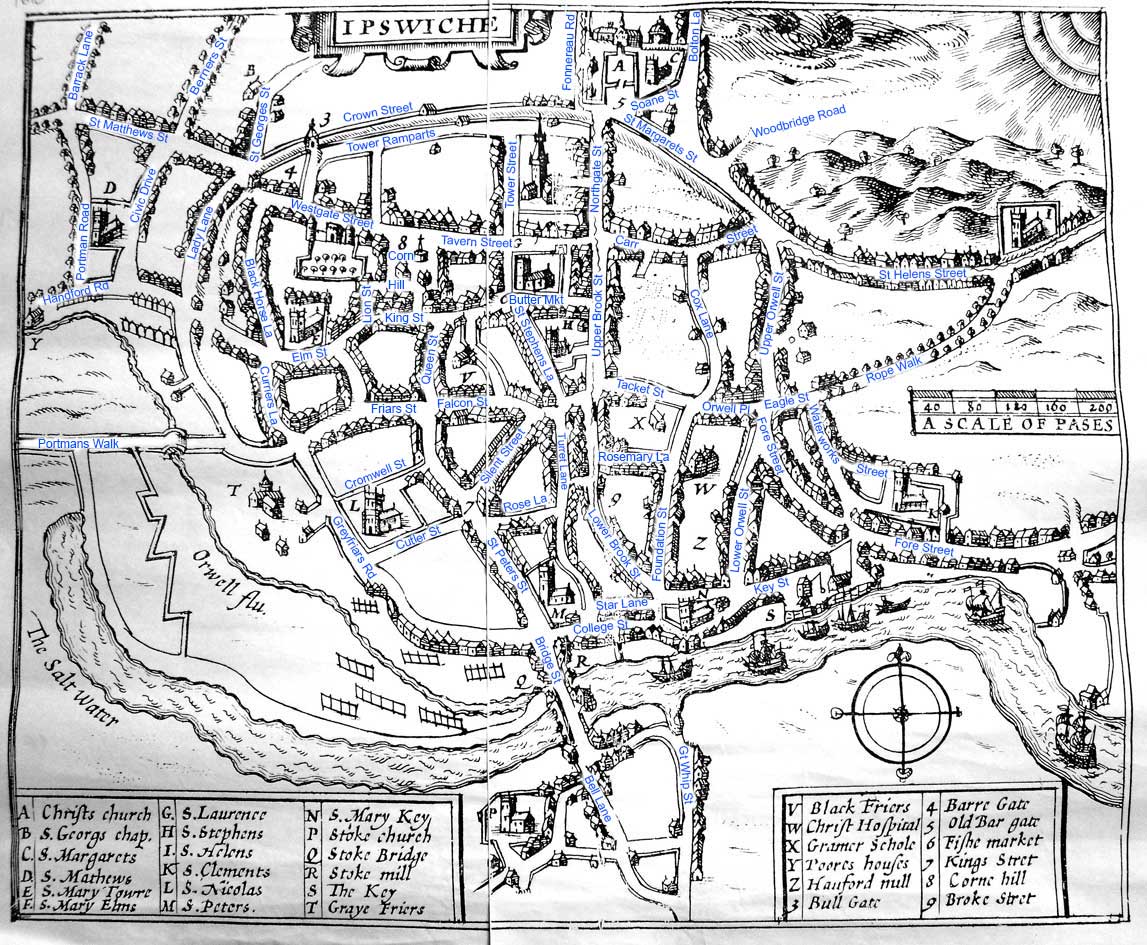
As an exercise in imposing the present day names onto the early 17th
century street plan, this illustrates that the Middle Saxon and
medieval layout of streets is largely unchanged in the 20th century.
The main exception is the Civic Drive area.
Home
Please email any comments
and contributions by clicking here.
Search Ipswich
Historic Lettering
©2004
Copyright
throughout the Ipswich
Historic Lettering site: Borin Van Loon
No reproduction of text or images without express written permission