Stoke Street, Tower Ramparts, Parkside Avenue
Muriel Clegg, historian of streets in Ipswich, wites: ‘One small improvement, possibly not recognised by those who went their accustomed ways, was the removal of the occasional ‘cancer’ or ‘caurncer’. With it went a word once familiar in the Ipswich vocabulary, though it may survive in folk memory. In June 1868, £50 was paid for the removal of a ‘carnser’ in Fore Hamlet. This may be the causeway reported in 1870 to have been removed in Wykes Bishop Hamlet. It projected into the public street and was an eyesore. When in 1881 plans of a new factory for Messrs. Footman, Pretty and Nicolson on Tower Ramparts included ‘an enclosure of part of the carncer now used as a public pathway’ members of a sub-committee concerned with streets went to view the scene, but apparently raised no objection… the carncer, which of course formed part of the medieval earthen rampart, or rather, such of it as remained. Strengthened with brickwork it provided a foundation and causeway for the houses built there. Houses, carnser and all were removed in the slum clearances of the 1930s.'
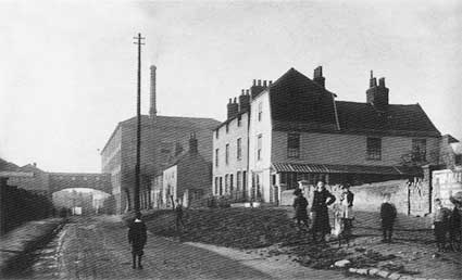 1890
1890Above: Tower Ramparts carnser 1890 rising to a pathway in front of houses built on the old earthen rampart. The view is from outside the 'Sailmakers' shopping centre; Electric House has yet to be built and the William Pretty & Son corset factory (now an NCP car park) with its bridge into the store – or perhaps a warehouse – dominates the west end of the street.
'The present day Tower Ramparts bus station reveals no trace of what was once there. The occupiers of houses built on the remnant of the town rampart in Lower Orwell Street went up steps to their homes and could see water flowing past below them. Stoke Street … had a causeway or carnser forming a raised pathway in front of the houses. This disappeared when in 1899 the People’s Hall was built on the site.'
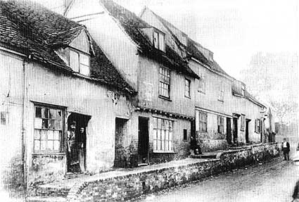 1896
1896Above: Stoke Street carnser 1896 (shortly before demolition); the view is from close to Bell Lane looking towards St Mary-at-Stoke Church (not visible) and the the left-right bends up to Belstead Road. The Methodist "People's Hall" (now mislabelled 'Stoke Hall') stands on this site.
'Parkside Avenue in Westerfield Road provides another example. Here, when Westerfield Road was little more than a sunken lane, the east side of the pathway had been buttressed but was in a dangerous state until by agreement it was repaired. Steps now lead up to the raised pathway.'
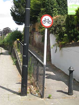 Westerfield
Road carnser 2018 image
Westerfield
Road carnser 2018 image'The word "carnser", however it was spelt, is old in town history. In November 1564 Christopher Crane was ordered ‘to sufficiently pave and land up the Caunsey next his house’, presumably in Tacket Street where he was living in 1569. In 1684-5 £15.7s.71/2d was paid ‘for the work at the Causey by Friar’s Bridge.’
[Main text from Muriel Clegg: The way we went, see Reading List]
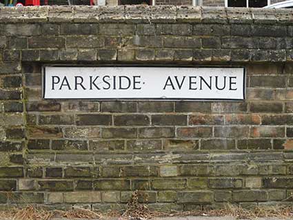
Parkside Avenue
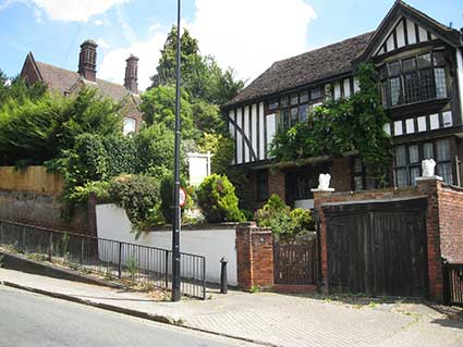
The Westerfield Road carnser mentioned by Muriel Clegg – the only one mentioned in her text which still exists – is today mounted by a ramped pathway from the town end to reach Parkside Avenue, quite a distance above.
 2018
images
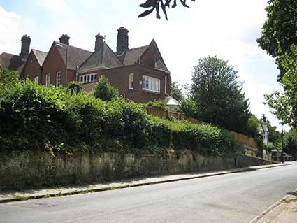
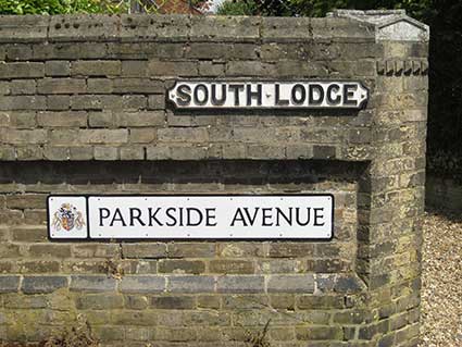
2018
imagesWhere it meets Constable Road, Parkside Avenue bears street nameplates on each side of the narrow road with, on the north side, a fine cast iron cartouche bearing the name of the house: 'South Lodge'.
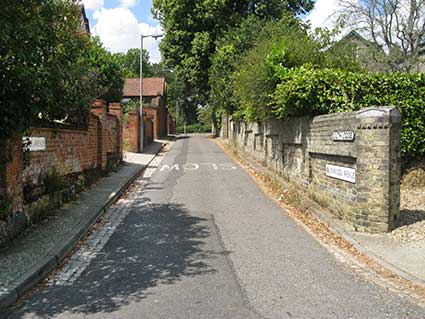
Below: the view from the Constable Road junction.
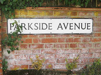
Back at the park end we see that the northern part of the carnser, where Westerfield Road drops down towards The Woolpack public house, is not a path but a road (Parkside Avenue rising to the sharp left-hand turn). A third street nameplate is fixed to the white brick garden wall of number 10. Sometimes small streets are named several times, where larger thoroughfares are hardly named at all (or have lost their street nameplates) – see also Dykes Street and Lion Street.
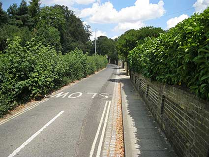
Above left: the view of Parkside Avenue from the sharp turn at the top; close to the left bend at the end (into Westerfoeld Road) is the street nameplate shown above right. The line of bushes to the left conceals the drop of the carnser; the mature trees visible across Westerfield Road are, of course in Christchurch Park.
©2004 Copyright throughout the Ipswich Historic Lettering site: Borin Van Loon
No reproduction of text or images without express written permission