John
Ogilby's map of Ipswich: 1674
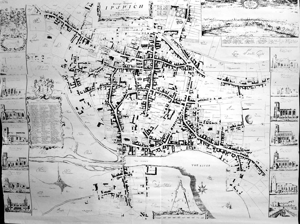
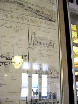
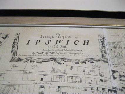
John Ogilby's map of Ipswich in 1674 is the first
large, detailed, to-scale plan of the town. The comparison to the Speed map of 1610 is striking, showing much
more sophisticated cartography and accuracy. After an
extraordinary and varied career, Ogilby's property and press were
destroyed in the Great Fire of London in 1666. Rebuilding in
Whitefriars, he set up a printing press there from which he issued many
magnificent books, the most important of which were a series of
atlases, with engravings and maps by Hollar and others. In 1674 he was
named to the salaried position of "His Majesty's Cosmographer and
Geographic Printer". The Britannia atlas of 1675 set the standard for
the road maps that followed. An innovation was Ogilby's scale of one
inch to the mile (1/63360). These are marked and numbered on each map,
the miles further being divided into furlongs. The buildings (mainly
churches) shown to the right and left of the Ipswich street map
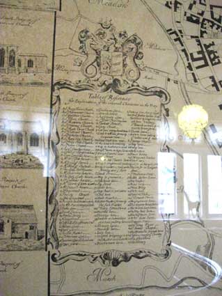
can be identified as shown below.
 Courtesy
Stephen Govier, Suffolk historian
Courtesy
Stephen Govier, Suffolk historian
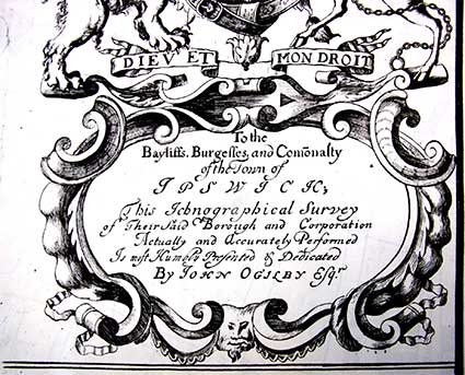
'To the
Bayliffs, Burgesses and Comonalty
of the Town of
IPSWICH,
This Ichnographical Survey
of Their Said Borough and Corporation
Actually and Accurately Performed
Is Most Humbly Presented & Dedicated
By JOHN OGILBY Esqr.'
Stephen Govier, to whom our thanks, has sent better
quality images of the church engravings from the Ogilby map, which we
include on the relevant pages.
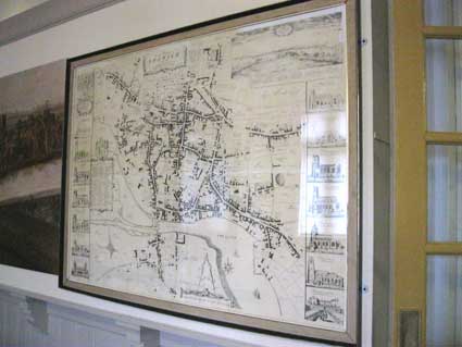
Given its relative historical importance, we have found this to be the
most difficult map about which to discover any commentary or detail,
let alone online imagery. However, we've discovered a very good framed
copy of the map in the Ipswich Museum, at
the top of the main staricase (towards the front of the building).
Images from this follow.
With the light from the Museum windows and lamps giving reflection
problems, here are the detail photographs of Ogilby's map.
 2012 images
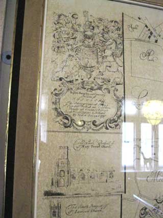
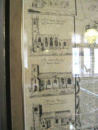
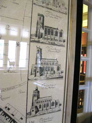
From top left downwards:
Ipswich Borough crest and title in cartouche
The South Prospect of St Mary Tower Church
"
St Lawrence Church
"
St Mary Elms Church
"
St Nicholas Church
"
St Mary Stoke Church
[mansion]
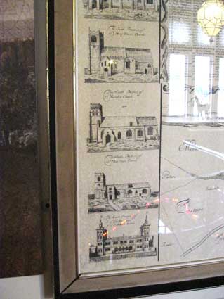
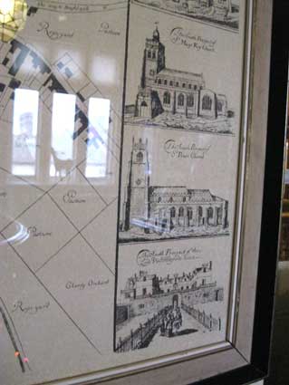
From top right downwards:
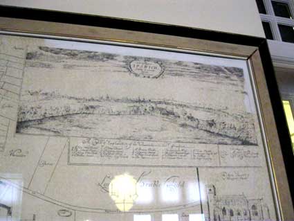
Landscape: South east prospect of Ipswich
The South Prospect of St Margaret's
Church
"
St Ellen's Church
"
St Stephen's Church
"
St Clement's Church
"
St Mary Key Church
"
St Peter's Church
[mansion]
Home
Please email any comments
and contributions by clicking here.
Search Ipswich
Historic Lettering
©2004
Copyright
throughout the Ipswich
Historic Lettering site: Borin Van Loon
No reproduction of text or images without express written permission