 2012
images
2012
images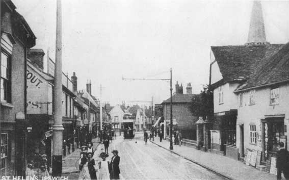
|
|
|
|
|
|
|
|
|
|
|
|
|
|
|
|
|
|
 2014 image
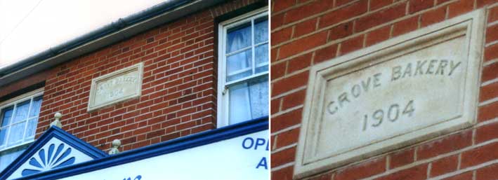 2000 image
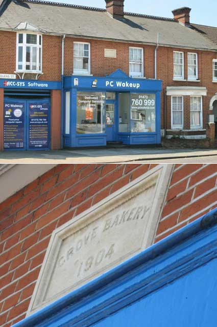 2012 images
IPSWICH CORPORATION
TRAMWAYS
Horse trams running from Cornhill to the railway station started in
1880. 1881 brought the Ipswich Tramways Act to establish the Ipswich
Tramway Company, a private enterprise. The tramway was extended from Princes Street, along Portman Road and
the upper stretch (then called Mill Street, presumably because of the
site of windmills at the top of the hill) to Barrack Corner on St
Matthews Street. This stretch was abandoned after only a few years.
There were also extensions from Cornhill
along Westgate Street and from Cornhill to
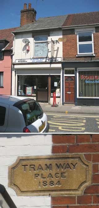
Major's Corner, St Helen's Street (the
site of our 'Tramway Place 1884' plaque shown above), Spring Road, St
John's Road, Cauldwell Hall Road to
Derby Road railway station. The stretch of tramline track from Major's
Corner to St Helen's Church was not made double until after the First
World War. If two tramcars had to pass one another, they could only do
so on a double loop of rail in St Helens Street at the junctions
with Grove Lane and with St Johns Road. The tracks at Derby
Road station were extended down into the
station yard to serve special rail excursions to Felixstowe. As
mentioned above, stabling for tram horses seems to have been provided
beside the Railway public house in Foxhall Road. Cross-town links meant
a total route mileage of 4.4 miles. Interestingly, the initial stock,
which consisted of three single-deck and six double deck cars, were
believed to have been built by the Starbuck
Car and Wagon Company of Birkenhead. Many of us might have imagined
that this very American-sounding trade name was an invention of a
certain modern coffee shop chain. Motive power was provided by a stud
of 27 horses: one for a single-deck and two for a double-deck car.
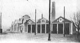
Power Station,
Constantine Road
In 1900 Ipswich Town Council took over the company
for Ł17,552
with the aim of introducing electric trams and electric lighting to the
borough. By 1902 work had started on the site of a tramway depot and
power station at Seven Acre Field (now Alderman Road/Constantine Road).
Due to very swampy conditions in this area of the borough close to the
River Gipping, a bed of concrete 40 feet square and 40 feet deep was
necessary to support the stack. This astonishing fact reminds us that,
like the massive Wet Dock
before it, the very large hole would have had to have been dug out by
hand, using pick and shovel.
 2013
images
2013
images
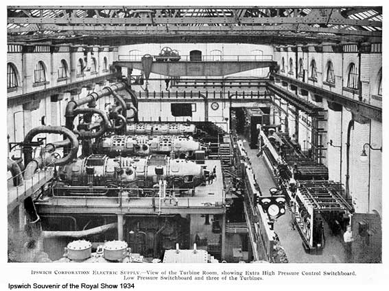
When we look at today's Constantine House
- the home of the original power station (later Eastern Electricity and
now housing Customer Service Direct offices which have provided Suffolk
County Council and Mid-Suffolk District Council with I.T. and other
services) and the next-door Ipswich bus depot, it's sobering to
remember that they are built on an enormous sugar cube of concrete. The
photographs above show some of the decoration on the building which is,
perhaps surprisingly, unlettered. The 21st century development of SCC's
Endeavour House, Grafton House: the Ipswich Borough Council
Offices (both in Russell Road) and Constantine House has led to the
erection
of an unsightly car park block very visible from West End Road. What
appears to be a small, attractive tram shed can still be seen from Sir
Alf Ramsey Way – formerly Portmans Walk – adjacent to Alderman Road
Recreation Ground and Bibb Way.
The attractive power station fascade (sadly lacking any lettering), now
Constantine House, was designed by London architect C. Stanley Peach.
The powered trams began work in 1903. Ł11,000 had been spent on
tramways and Ł43,000 on street widening which changed the face of
Ipswich in certain locations (presumably the area opposite The Great
White Horse in Tavern
Street and at the top of Upper Brook Street
were opened up as part of this process. A narrow tramway guage (and,
logically, narrow tram car fleet) was chosen because of difficulties in
accomodating other traffic (pricipally horse-drawn carts and perhaps a
very early motor vehicle) either side of the tracks on the narrow roads
of old Ipswich.
[UPDATE 24.9.2017: "Hallo
Borin. I lived in Ipswich for 35 years, then retired and moved to Diss.
I come to Ipswich every couple of weeks to meet friends for coffee or
lunch and, interestingly, I now see Ipswich with a visitor's eyes and I
walk around a lot exploring the architecture etc. Recently I started
coming on the train (a great pleasure!) and was walking back to the
station from Westgate Street. I meandered past Portman Road and past
the incredible Constantine House, which I had never seen before.
Searching for it on the internet I came across your website and got all
I wanted – and much more. It's incredible and wonderful! So, many
thanks for a cornucopia of leads to be following up in my visits.
Yippee . . . All the best, Trevor Ault. Many thanks to Trevor for the encouragement.]
See our Lloyds Avene page for more
on the Electric House showrooms.
This aerial view of the Constantine Road Tram Depot and Power
Station, Ipswich, 1933 is from the excellent Britain from above resource (see Links):
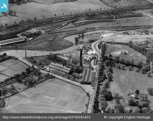
This dramatic view shows a circular lagoon on the River
Orwell/Gipping (marked 'Bathing place' on a 1930
map
of Ipswich) surrounded by an 'S' shaped meander; nearby
is the peninsula which is now home to the Voyage tower block.
See our Ipswich in 1912 PDF for a
photograph of this bathing place on page 33; see also our Water in Ipswich page for
more on bathing places.
The
Reavell 'Ranelagh Works' are over the river with its railway line
bridge
crossing Ranelagh Road to join the main line near the top of the image
with Gippeswyk Park, gift to the town
from Felix Thornely Cobbold,
above that. The Constantine Road power station with its tall chimney
stands in the countryside with a meadow where today we find the Ipswich
Town practice ground, fields and gardens where SCC's Endeavour House
and IBC's Grafton House now stand, little sign of West End Road along
the riverside and the Alderman Road public park more-or-less as it is
today (inevitably smaller). Portman's Walk, as it used to be called
(now Alf Ramsey Way),
appears from the bottom of the frame and travels up, then curves
sharply round the site of the modern recycling centre ('dump').
The system consisted of about a mile of double track
through the town
centre (Barrack Corner to Major's Corner) and the remainder was single
track with passing loops. It was extended as follows:-
Quadling Street
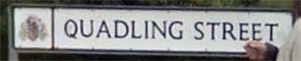
Above: the modern street nameplate marks the slightly odd route
of the street through 'Cardinal Park' today.
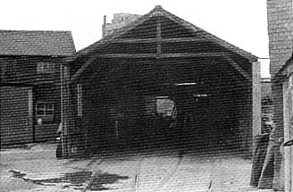
This photograph shows the timber-built horse-tram depot in Quadling
Street
(on the corner of Cecilia Street) from the 1980s. Although closed down
in June 1903 and the nine tramcars sold off as chicken sheds etc.
and all 27 horses auctioned to new owners, the depot was used by a
building firm until shortly before its demolition. You can see the
tramcar rails entering the building. The remainder of the rails had to
be lifted and replaced as they were too light for the electric trams.
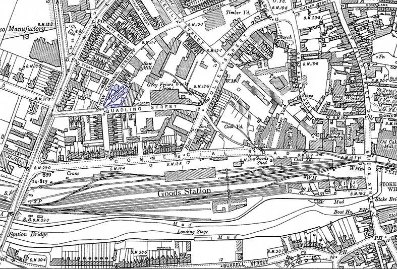 1902 map
The
'Tramway Depot' is shown in purple – west of the 'Grey Friars Works
(Iron)' of E.R.&F. Turner – with tracks running into Quadling
Street and west into Princes Street. The tramway tracks within the
Turner foundry are divorced from those running up Commercial Road (now
Grafton Way) from Bridge Street which run into the 'Coal Yard'. Perhaps
they once continued along the curving lane/passageway still evident on
the map to serve the foundry.
PUBLIC TRANSPORT IN IPSWICH: a summary
timeline
13.10.1880 First (privately owned)
horse-drawn tram service started: Cornhill to Railway Station.
1881 This tramway was
taken over by the Ipswich Tramways Company; services were extended to
Brooks Hall, Norwich Road.
1883 Horse-drawn
tram services
were extended from Majors Corner via St Johns Road to Derby Road
railway station.
c.1898 Horse-drawn tram services
were extended to The Whitton Crown, Norwich Road.
1898 Privately
owned horse-drawn
omnibuses were introduced services to Bramford Road (Red Lion?) and to
Wherstead Road.
c.1899 Horse-drawn tram services
were extended down St Nicholas Street to Vernon Street.
c.1900 Horse-drawn tram services
were extended to Wherstead Road.
1901 The horse trams were
taken
over by Ipswich Corporation Transport (ICT).
1903 All horse-drawn
services were
replaced by electric trams. Major works included replacement of
existing 3 feet 6 inches tramway rails by heavier duty rails; also cast
iron poles to carry the overhead electric current were installed. New
services to Lattice Barn and Felixstowe Road were introduced. Services
were extended to Bath Street in Over Stoke and to Spring Road (beyond
St Johns Road).
1904 Electric tram
services were
extended to Bishops Hill and The Royal Oak, Felixstowe Road.
1919 Motorbus services
were
introduced by the Eastern Counties Road Car Company (ECRCC) on town
roads not served by the trams: Foxhall Road, Woodbridge Road, London
Road, Hadleigh Road, Henley Road, Westerfield Road and Tuddenham Road.
1922 The ECRCC
Introduced local
services within Ipswich. Some (e.g. Cemetery Road) were short-lived;
others (e.g. Constable Road) lasted to the 1970s.
1923-1926 Ipswich Corporation replaced its electric
trams by trolleybuses (1926 trolleybuses had chassis manufactured by
the Leiston engineering firm of Richard Garrett & Sons, with motors
made by Bull Motors, formerly E.R & F. Turner). As the town grew
services were extended along London Road, Woodbridge Road, Sidegate
Lane, Foxhall Road, Nacton Road and to the Gainsborough estate. From
1926 to 1950 the Corporation ran only trolleybuses on their public
transport services.
1924-1940 The Ipswich engineering giant, Ransomes
Sims & Jefferies, manufactured trolleybuses and supplied many to
Ipswich Corporation.
1931 The ECRCC was
incorporated in
the newly-formed Eastern Counties Omnibus Company (ECOC).
1948 The ECOC was
nationalised.
1950 The Corporation
introduced
motorbus services, gradually replacing trolleybus services from 1953 to
1963. Motorbuses were used on new services to the new fringe estates:
White House, Maidenhall, Castle Hill, Chantry, Broke Hall and Stoke
Park.
[The above is based on the information in Bob Markham's 1980 book 100 years of public transport in Ipswich, a pictorial survey (see Reading list).]
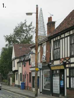
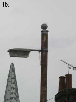
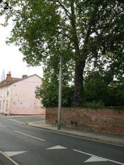
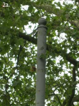
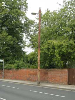
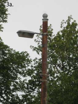
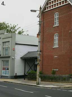
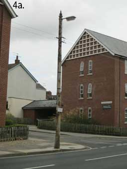
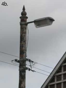
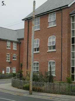
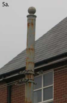
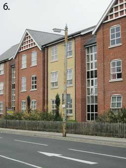
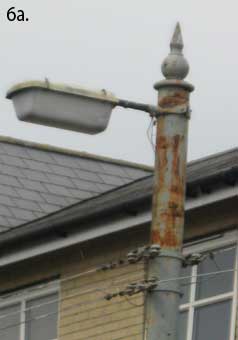
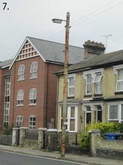
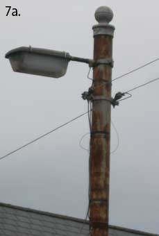
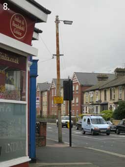
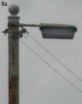
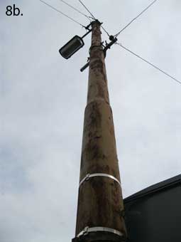
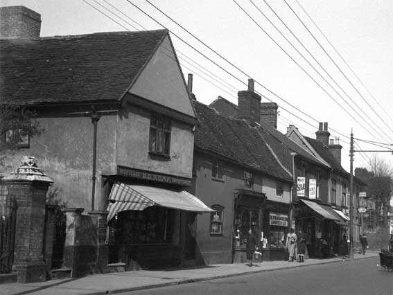
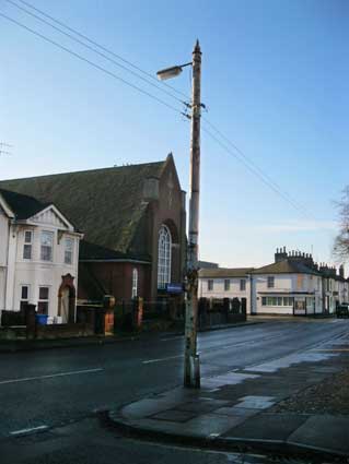
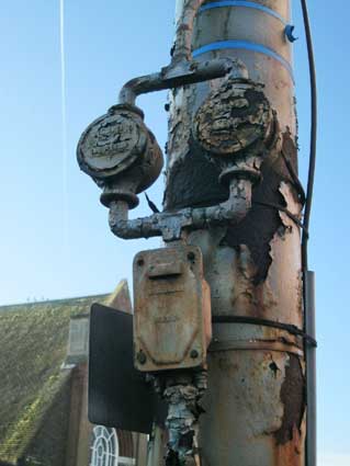
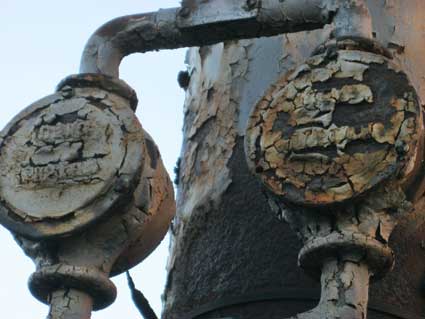
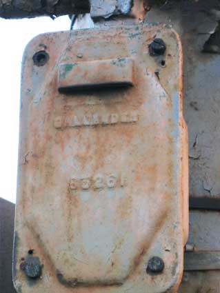
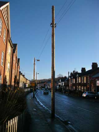
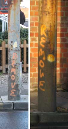
Some of the cast iron poles which carried power
lines for the trams were
still in place in the town until 2017 (see St Helens Street Tramway posts, above), a number
being reused to carry street
lighting and BT telephone cables. These posts are often seen in old
photographs of Ipswich with their horizontal bars carrying
insulator-protected power cables, sometimes in complex networks at
termini and junctions. What happened to the tramway? The
system was difficult to
keep running during the shortages of the First and Second World Wars
and some tramcars had the ignominy of being painted grey, as the
traditional Ipswich Corporation Tramways livery couldn't be maintained.
The track and trackbed suffered damage from iron cart wheels and other
heavy vehicles and the whole system became uncomfortable (especially as
the upper deck was open to the elements), unreliable and unpopular. All
rails were lifted in the town except those outside the Police Station near Cornhill which were
covered over and remain intact today. Later, power lines were largely
kept in place to enable electric trolley buses to replace trams.
Ipswich was probably the last municipal authority in the country to
convert, in 1950, to the more popular internal combustion motor buses.
The last trolley bus
entered the depot at Constantine Road in 1963. In the circular way of
things, anyone visiting the East Anglia Transport Museum in Carlton
Colville near Lowestoft in the north of the county will be struck by
the 'nearly silent' operation of the trolley bus used for visitor rides
in a world where we are all to used to the roar and chug (and fumes) of
the diesel
engine universally used in 21st century heavy vehicles. Yet we are
delighted and amazed the first time we travel silently in an electric
car... Nothing changes.
[Much of the above information came from 'Tramways of East Anglia' by
R.C. Anderson; see Reading List.]
See also the Suffolk Mills Group document on Windmills in the Borough of Ipswich (click to open the PDF).