Water
in Ipswich
Rivers, springs (a
spa town?),
marshes, sewers, bathing places, floods, riverside sculptures
Scientists aver that water on our planet probably came from one
or more 'dirty snowball' comets colliding with the cooling sphere (more
accurately, an oblate spheroid),
creating the potential for life on Earth. Furthermore, today there is
not a drop more and not a drop less of water than there was initially
trapped by our atmosphere.
The streets of old Ipswich were paved not with gold but, very often,
with water. The bowl-shaped terrain of Ipswich centres on the familiar
natural dock with its clearly defined, sharp left-hand turn in the
River Orwell (at Neptune Quay) as it narrows and flows to meet the
non-tidal Gipping. So, at once we have a wide, tidal estuary stretching
up to a large, open pool – sheltered from coastal storms – then
narrowing westwards to the River Gipping which continues into the heart
of the
county. This natural feature is the main reason for the establishment
of the nucleus of the Anglo-Saxon town at this point; more specifically
it is the
narrowing and shallowing of the waterway around the end of today's
Great Whip Street which made the river
fordable. A crossing point on a
water highway, allied to a natural dock is an excellent place to
establish the nucleus of a town. So it was with the Anglo-Saxons and
Gippeswyk, their first town.
Another natural feature which attracted them is the presence of so many
springs in the
surrounding hills of the 'bowl'. The water percolates to the surface
through green sand and gravel layers, purifying it. The clean spring
water is held in the permeable Red Crag above, but cannot penetrate the
alluvial clay present in areas of Ipswich, so it
flows downhill on the surface. This is particularly so of the springs
around Cauldwell ('cold well/cold stream') Hall and those found in and
around
Christchurch and Holywells ('hollow wells' hence the name)
Parks. See our Street name derivations
page for these and many other sources.
The rivers Gipping & Orwell
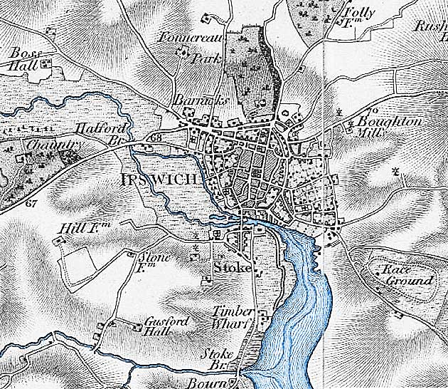 1777 Chapman and Andre map
Detail above is from www.VisionofBritain.org.uk
The
Wet Dock and New Cut were created in 1842.
Above, the natural dock, pre-Wet Dock enclosure, at lower right
and the narrower
river to the west of Ipswich which splits into two between Stoke Bridge
and Handford Bridge at upper left. Rober Malster (see Reading List Ipswich
A-Z) tells us that "the one that flows along the edge of the
valley towards Handford Mill is usually marked as the Gipping, while
the main channel flowing down the middle of the valley is often
delineated 'The salt water'. The more northerly channel is clearly
artificial, but it is of great antiquity: it already existed in AD 970.
Archaeologists have found a Roman settlement beside it, and the channel
may have been excavated during the Roman occupation of Britain [c.AD285
- 480]... There is some evidence that until the 18th century the whole
river from Rattlesden [near Stowmarket]
to the sea was known as the
Orwell, and the stream flowing into Stowmarket from the north was
considered a tributary; there is an Orwell Meadow in Rattlesden." Today
we consider that northward tributary to be a continuation of the
River Gipping, with its source near the village of Gipping; we
call the
tributary from Rattlesden to the Gipping the River Rat or the
Rattlesden River.
One or two points arise from looking at this map. Handford Bridge is
mistakenly labelled 'Halford Br.'. The Chantry to the west is labelled
'Chauntry'; the Artillery Barracks at
Barrack Corner on Norwich Road are labelled. Today's Christchurch Park is labelled
'Fonnereau Park'. Pairs of windmills are shown either side of the road
on Belstead Road hill and on Albion Hill
(the latter labelled 'Boughton Mills', perhaps named after the owner).
The 'Race Ground' at today's
Racecourse and Gainsborough housing estates is labelled to the east.
Within Ipswich, the split in the river is sometimes labelled 'River
Gipping' to the north and 'River Orwell' to the south; interestingly
this practice is continued on modern computerised maps available on the
internet. The Gipping navigation met demands for narrow boats to carry
materials and goods between Stowmarket, Ipswich and the sea. However,
anyone walking along the Gipping River Path (much of it along a horse
tow-path) will learn from the information panels that the use of the
river by boats goes back centuries. The River
Gipping was officially closed as a navigation in 1932. The area between
the two river branches was Portman's Marshes.
Marshes
Areas to the south and the west of the natural harbour provided by the
River Orwell were particularly known for their marshy character. The
extensive waterlogged land provided a natural defence for the town,
making it very difficult to launch an attack on foot or on horseback.
The river itself provided a defence, too. We have to imagine the river
as much broader and shallower around the original fording point used by
the Anglo-Saxons (and probably the Romans before them) from Great Whip
Street in the south and Foundry Lane in the north (another route for
the ford into Turret Lane has also been proposed). The Church of St Mary-At-Quay was famously built on the
marshy ground where the spring waters from the surrounding hills pooled
on its way into the river. At the time of Cardinal Wolsey, when his
Water Gate into his ill-fated College
was built (c.1528), the river revetment (strengthened bank forming a
quay) was around the line down the middle of College Street. This is
but one example of the way in which the broad, marshy areas were
drained and reclaimed and the riverside gradually moved back to its
present location on the northern quays of the Wet Dock. John Norman
tells us that the use of ballast (usually sand, gravel or broken stone)
by
trading vessels to ensure stability while sailing empty aided this
process. When docking and prior to loading of the cargo, the ballast
was removed from the holds and dumped at the river bank. Many
repetitions of this process would hasten the extension of the hard
quays and the narrowing of the natural harbour.
Mention of the marshland and rivers as natural deterrents to attack
brings up the thorny question of the rampart-and-ditch
town defences. Stephen Alsford's excellent website History of
Medieval Ipswich (see Links) tells us:
'The line [of the ditches] was clearly suggested in the topography of
the streets into the 19th century (although less so with late
20th-century redevelopment), including street names like Tower Ditches
and St. Margaret Ditches. According to a note in one of the Ipswich
Domesday Books, the ditches were dug in 1203; but this does not rule
out the effort simply being an enlargement or extension of an earlier
line of defence. There are fairly frequent references to grants of
parcels of the town ditch, particular along the northern boundary,
where they are sometimes referred to as the "great ditches of the
town". Walls are far less commonly mentioned and their extent is
uncertain. In 1302 a burgess was granted a lease of part of the
ditches, for 6d. a year, to be voided if the town were ever enclosed by
a wall. We hear of town wall in St. Margaret's parish in a grant of
1315, and in St. Mary Elms parish in 1323. A change had occurred
between the compilation of a custumal in 1291 and its translation into
English in the fifteenth century, since the former refers to a
watercourse called "Botflood" (the flooded town ditch?) passing along
the side of a road, while the latter refers to it running alongside the
wall. What wall-building there was may have focused on areas where the
ditches were weakest and may never have proceeded to creation of a
continuous line; the eastern and western sides of the borough clearly
had walls, but it is less certain that the northern perimeter did.'
Alsford depicts, to the east, the
defences as running from Common Quay on the Wet Dock northwards up
Lower Orwell Street, [probable site of the East Gate], Upper Orwell
Street past Majors Corner, then westwards along Old Foundry Road (St
Margaret's Ditches), [site of the North Gate], Tower
Ramparts, [site of the West Gate], then
southwards down Lady Lane and the former
Tanners Lane (now beneath Civic Drive) as far as Friars Bridge Road. The last section
has changed dramatically due to 'modernisation' in the 1960s (see 'Ipswich tomorrow'). It is assumed that
there was no need for an earthwork south of this via Greyfriars Road to
Stoke Bridge because of the rivers and
marshes, water providing a natural defence. Marshland provided ideal
grazing for animals. For the six hundred years, between the granting of
the Royal Charter in 1200 and the Municipal Corporations Act 1835, the
town was run by Bailiffs, Burgesses, and Portmen (the 'great and the
good' of the town). The name Portman's Marshes recalls the first
Portmen of Ipswich who were granted a meadow named Odenholm or
Oldenholm on which to keep their horses. Others have said that they had
the right to graze their cattle there – perhaps both are true.
The regular tidal inundation of the the channels and
gullies of the marshes enabled this collected water to
be used to drive the Tide Mill alongside Stoke Bridge. After the
Municipal Corporations Act 1835 the marshes passed to
Ipswich Corporation and municipal buildings have been built upon the
land ever since. In fact Pennington's map of
1778 shows the legend: 'Land belonging to the Corporation' right
across Portman's Marshes. What was once an area of little practical
use, this large area was eventually drained and developed to provided
land
for:-
1. the building of the town's first coal-fired power
station in today's Constantine Road (which also burnt the town's
rubbish to generate power);
2. a Sewage Pumping Station (marked on the 1902 map)
pre-dated the power station and was situated nearer to the river on
Constantine Road;
3. the related electric tram depot (stillused by Ipswich
Buses) next door;
4. Portman Road football ground which from 1855 was the
home of East Suffolk Cricket and more recently an internationally-known
location; Ipswich Town Football Club have been leasing the ground from
the Borough since 1936;
5. the new Cattle Market, which had moved from the top of
Silent Street (see our Old Cattle Market
page) in 1856 and occupied a substantial area of land, either side of
Princes Street, and operated here until January 1985; scroll down to
the foot of this page for the old railway cattle pens;
6. the Drill Hall, where Ipswich’s Volunteer Reserves met,
was on the junction of Friars Bridge Road and Portman Road;
7. Commercial Road was the first street to be constructed
in the 1850s, providing access to the Railway Goods Yard;
8. Cardinal Park with its car park, cinema,
clubs, bars and
restaurants was built on the former Ipswich Corporation depot site
between Commercial Road (renamed Grafton Way) and Grey Friars Road;
9. most recently, Ipswich Borough Council moved its
offices from the CIvic Centre to Grafton House in Russell Road
(opposite Suffolk County Council's offices in Endeavour House) in 2005.
[Information from John Norman's Ipswich Icons column.]
 1896 map
The 1896 map shows the post-Industrial Revolution river system
(marked in blue). Above the legend 'Halifax' and on the west bank we
see the Griffin Wharf branch railway crossing Wherstead Road to reach
the river. North of that is the enclosed Stoke Bathing Place. The Wet Dock, opened in January
1842, shows two locks, one off New Cut and the one we know today at the
south. The lock half-way up New Cut was never popular
with mariners: the sharp turn required to move a vessel in line with
this lock – particularly when approaching from the north-west – led to
some collisions. The south lock was built between 1869 and 1871 to
remedy this problem. The Promenade with its avenue of lime trees was
the place to be seen on a summer Sunday afternoon stroll down to the
'Umbrella' shelter and Pegasus statue, with views over the river to Hog
Highland (south of
the Cobbold brewery), it existed
between the old and new locks. In 1904 Timber Quay was built over the
inner end of the old lock making it unusable. There
were originally no quays between the Wet
Dock and New Cut, the majority was taken up by a 'mill pond' (clearly
shown on the above map) which provided a head of water used to operate
George Tovell's
roman cement works. The pond, later used for storage of timber, became
a branch dock, but was filled in during works on the Island in 1923-5.
Tovell's Wharf was constructed on the north side of the Island.
Additional notes on the 1896 map.
The branch line from the Great Eastern Railway can be seen on the map
running across
a level crossing on Ranelagh Road and over the river by
a
small bridge, then
round to goods sidings and the tramway which ran all around the Wet
Dock and
beyond. Parts of these trackbeds can still be found, but many rails
have been lifted. Another point of interest is the area at the southern
end of Sidegate Lane (upper right of the map) labelled 'Australia'.
This would be around Hutland Road and Meadowvale Close (the site of St Helens Barracks). But why
'Australia'? Probably a similar 'frontier' feature to California. Interestingly at this time
Belvedere Road with its bridge
over the Felixstowe branch line is shown in dotted lines. See
our Friars Bridge Road page for more
on Greyfriars and the Little Gipping.
Where Gipping becomes Orwell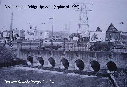
The legend 'Wier' [sic] north of Handford Bridge on the 1896 map
is the
Horseshoe Weir.
It is clearly visible on the 1902 map (below) because it is drawn in –
north of 'Seven Arch Bridge (now replaced) carrying London Road – and
labelled:
'Highest Point to which Ordinary Tides flow'. It is
generally agreed that at the
Horseshoe Weir, or just below it, the freshwater River Gipping meets
the brackish water of the River Orwell, dependant on the strength of
the spring tides. Note also on the 1902 map
the 'West End Bathing Place' (see 'Bathing places' further down this
page) at the south of the long thin 'island' and at the west end of
Portman's Walk (now renamed Sir Alf Ramsey Way); swimmers accessed the
pool
via a footway across the lock gates where we find a repeat of the the
label: 'Highest
Point to which the Ordinary Tides flow' on this leg of the river. So,
in summary, the point
where the freshwater Gipping meets the brackish Orwell moves between
the lock and the Horseshoe Weir, dependant on the tides.
Just north of the lock is
the arm of the Alderman Canal. In the past a further section of the
Gipping existed, sometimes known as the “Little” or “Upper” Gipping,
thought to be a manmade cut which flowed east from the Gipping in
Ipswich parallel to Handford Road, before dropping south-east, parallel
to what is now Civic Drive, Franciscan
Way and Greyfriars Road to rejoin the River Orwell at Stoke Bridge. Only a section of this river
now remains, known as Alderman Canal reaching east to Alderman Road,
with a return ditch flowing below Alderman Canal, under Bibb Way,
through a reedbed to Sir Alf Ramsey Way (Portman's Walk) where it is
piped underground
to the River Orwell exiting in the vicinity of Constantine Weir. The
return ditch was presumably dug when the section south-east from
Alderman Road was stopped up in Victorian times.
The
River Orwell is easy to trace because it follows much the same line
today: the south western edge of the marsh. Following the 1953 floods,
the river was canalised, sheet piles driven into both banks to stop the
town flooding – not particularly attractive at low tide. Since the 1902 map West End Road was built from
Commercial Road, crossing London Road, and into Yarmouth Road (the
1930s Ipswich By-Pass). These roads now occupy the long thin island
between the two rivers. There is a
footpath alongside the river from Stoke
Bridge, under Princes Street Bridge, the Bobby Robson Bridge and as far
as the weir close to West End Road. As it approaches Yarmouth Road it
splits, the
route straight ahead becomes the tidal Orwell but the fresh water
diverts left under Yarmouth Road, under Handford Road bridge and across
Alderman Road recreation ground to the site of Handford Mill (at the
top of Alderman Road). From there, it is underground, contained in a
culvert (Little Gipping Street marks the line). It crosses the site of
the former Portman Road cattle market, under Friars Bridge (clearly
shown on Edward White’s map of 1867) where it provides evidence of its
presence behind the Greyfriars car park with an elongated hump in the
ground, which crosses Wolsey Street, close to the back gate of
Jewson’s. The Gipping discharges into the Orwell just above Stoke
Bridge appearing under the Skate Park. When the Gipping was made
navigable in 1793, a lock was cut between the two rivers near West End
Road (Handford Lock). The lock gates have gone and a flow control gate
has been installed, holding the waters of the Gipping at a constant
level up to Sproughton. The waters of the Gipping cascade, waterfall
style, into the Orwell.
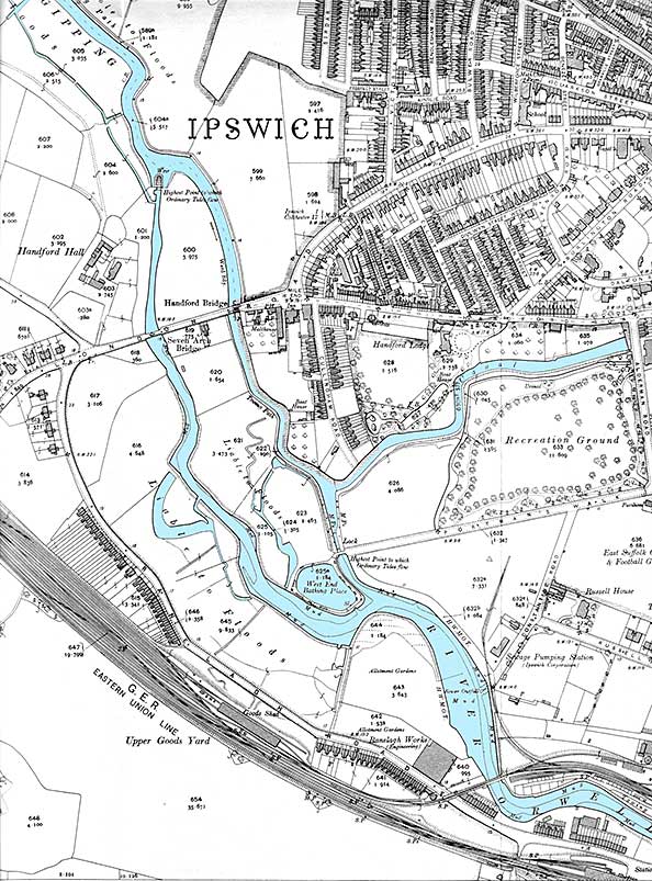 1902 map
Note also, on the 1902 map, the complex layout of the 'G.E.R. Eastern
Union Line' – how nice that
the original name of the Eastern Union Railway
from Colchester to the original station in Stoke is still used here;
the first EUR train ran in 1846, becoming Great Eastern Railway in
1862. As the goods spur comes off the main line, crosses Ranelagh
Road by a level crossing (vestiges visible today), crosses the Orwell and turns
towards the docks, another smaller line comes back westwards and
northwards away from the goods sidings to run beside the opposite bank
of the river, over the cul-de-sac of Constantine Road and round behind
the 'Ipswich Corporation Sewage Pumping Station' and the future site of
the power station and tram/bus depot. One assumes that the main purpose
of this branch was to supply coal to the power station which generated
electricity for the trams and trolley buses and also for residential
use. At the time that this map was published, work had only just begun
on building the power station (Constantine
House) and tram depot.
Handford Mill on the Alderman Canal
Handford Mill was a
water-powered mill standing at the east end of this stretch of water,
close to Handford Road (see Street name
derivations). It is believed originally to have been fed by a
stream
running down from the Anglesea Road area, but an artificial channel was
dug to bring water from a new weir built on the Gipping some way above
Handford Bridge. This channel was certainly in use when the bounds of
Stoke were set down in AD970; it is possible that this was dug by the
Roman occupants to bring water to a mill on or near the site of
Handford
Mill (the first written record of which is found as
early as the 13th century). In the 19th century the mill was used to
crush seed to extract oil; no traces of it apparently now exist. A
valve
prevents
flow between the River Gipping and Alderman Canal. The Alderman Canal
now only receives surface run-off from its immediate surrounds
(principally properties along Handford Road). The Rivers Orwell and
Gipping were formerly navigable by means of locks and as recently as
the 1970s boats could be hired from Wrights Boatyard, Cullingham Road (on the
River Gipping,
just north of Alderman Canal). In addition to boat hire, the Yard
offered boat manufacture and repair/maintenance.
 1938 image
Above: the Little Gipping (Alderman Canal) with Handford Mills in the
lower part of the 1938 aerial photograph. Cullingham Road runs from
left to right a little higher up. At the junction with Handford Road,
London Road curves round to meet it.
Little Gipping &
Great
Gipping
Streets, Canham Street
 2016 images
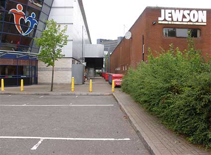
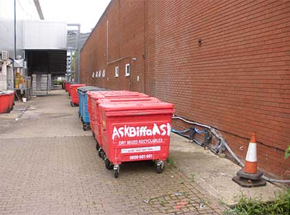
'LITTLE GIPPING STREET' 'GREAT
GIPPING STREET' are located in a small housing estate to the west
of Civic Drive and delineated by Portman
Road, Civic Drive and the
large car park block of the Axa offices. Presumably the
Alderman Canal would once have continued in a loop round to join the
main river just west of Stoke Bridge. This watercourse still exists as
the Little Gipping River which runs underground and in culverts beneath
these roads, under Friars
Bridge Road and south eastwards
under a 'bump' in Wolsey Street (see photograph below), then between
the Jewson block and the
Cardinal Park gym and restaurants (you can see the cover over the
culvert where wheelie bins are stored on the photographs below) to an
outfall into the Orwell. (N.B. Great Gipping
Street is also home to the bicycle symbol
pressed into the railings.)
 2021 image
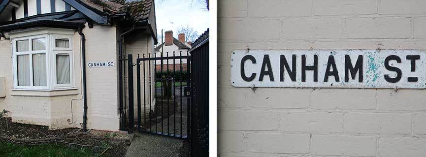
Above: nearby is Canham Street, which joins Portman Road and Great
Gipping Street in an arc. At the latter junction is an older street
nameplate on the bungalow wall, a style seen elsewhere in the town and
probably in cast aluminium. The superior 'T' is characteristic of this
style (perhaps early 20th century). Compare with other styles on the Street nameplates page. See the Street
names derivations page for the derivation.
 Photos
courtesy Bob Markham
Photos
courtesy Bob Markham
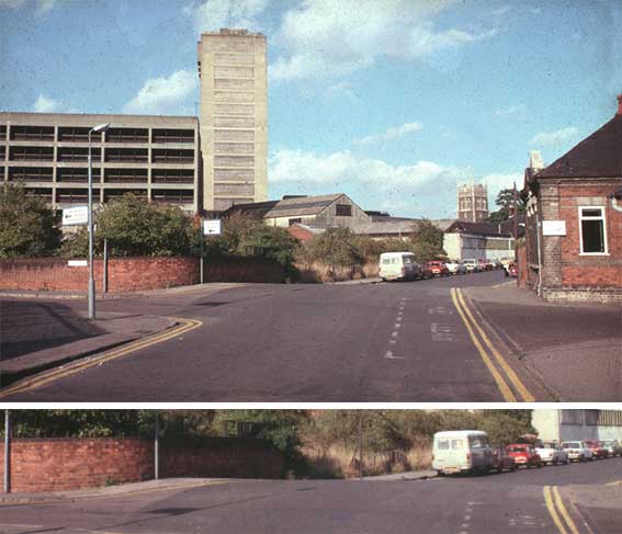
Below: Wolsey Street shown in the 1960s from the Ipswich Society's
Image Archive (see Links) – "[View] from the
Cecilia St (left) junction after partial clearance of
the area. The Zulu Inn stood on the left hand corner in front of St
Francis Tower. St Nicholas Church tower can be seen over the white
painted building in the right background and part of the Greyfriars
development and St Francis Tower on the left. The slight hump in the road was a result
of the Little Gipping river being bricked over and used as a sewer in
Victorian times. It discharges into the main river in St Peters Dock
just upstream of Stoke Bridge. This hump in the road still exists just
to the north of Cineworld Cinema at the junction of Cecilia St, Wolsey
St and Quadling St." (see our Lost trade
signs page for an earlier
photograph showing the Zulu Inn with the Greyfriars muti-storey car
park and St Francis tower under construction behind.)
 Photograph
courtesy The Ipswich
Society
Photograph
courtesy The Ipswich
Society
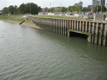
Below: two outfalls from underground conduits into the River
Orwell,
photographed from Stoke Bridge.
 2018
image
2018
image
The Ipswich Brook
A
similar outfall exists for the Ipswich Brook which is the underground
version of the waters which flowed for centuries down Northgate Street,
Upper and Lower Brook Streets; it flows under Star Lane to reach the
Orwell and eventually the sea. The Ipswich Brook existed as a
watercourse carrying the copious spring water and surface drainage
water
which flowed down the sides of the 'dish' of Ipswich to reach the main
river two thousand years ago. Another brook started
high up the hillside at the site of today's Warrington Road flowing
down to help power Handford Mill...
The water-mills. See
our Friars Bridge Road page for much
more on these mills and the way in which water has been managed in the
town.
The Mill River: a 'lost' river in
Ipswich (also, the pioneer
archaeologist Nina Frances Layard)
John Norman's column in the local press often provides surprises
and this 'Ipswich icons' (Anglo Saxon cemetery in Hadleigh Road,
May 2016) is particularly germain to a page about water in Ipswich.
"There is a dip in Foxhall Road, a depression that is in geographical
terms the start of the Mill River.
No sign of water just here but the valley runs south and then east,
across Bixley Road and then parallel with Bucklesham Road, where the
first surface trickle is encountered. It continues onto Purdis where it
forms ponds on Ipswich Golf Club’s course. On to Foxhall then Newbourne
where it gets a name on the map§, and finally to Kirton
Creek, where it discharges into the Deben.
In a mere eight miles and a few feet of descent the trickle has become
a small river with a wealth of wildlife but it is at the Ipswich end
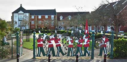
that our journey starts. Opposite Henslow Road today is a children’s
pocket park, entered through marching band-shaped gates of fascinating
interest.
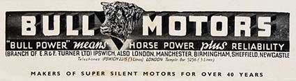
 Foxgrove Gardens is an estate
of 288 flats and town houses, built in
the late 2000s by house builder Barratt Eastern on the 14-acre site
previously occupied by Bull Motors and Celestion Speakers. Prior to
this it was a brickworks, and a considerable number of years before
that the very earliest Europeans lived here. They were hunter
gatherers, chasing animals, collecting berries and living an existence
lifestyle. They lived here in the Palaeolithic period – about half a
million years ago. How do we know this?
Foxgrove Gardens is an estate
of 288 flats and town houses, built in
the late 2000s by house builder Barratt Eastern on the 14-acre site
previously occupied by Bull Motors and Celestion Speakers. Prior to
this it was a brickworks, and a considerable number of years before
that the very earliest Europeans lived here. They were hunter
gatherers, chasing animals, collecting berries and living an existence
lifestyle. They lived here in the Palaeolithic period – about half a
million years ago. How do we know this?
It is primarily due to the dedicated work carried out by an Edwardian
lady, Miss Nina Layard. She was born in Stratford, Essex, in 1853,
lived in a number of different places before she moved to Ipswich when
she was 36. Nina had always had a fascination for the earth sciences
and in 1898 she began studying Ipswich’s archaeology.
She was given
some flint tools found in Levington Road when the houses there were
being built (1894-1901). These were Nina’s first positive indication of
the Palaeolithic occupation hereabouts.
in 1853,
lived in a number of different places before she moved to Ipswich when
she was 36. Nina had always had a fascination for the earth sciences
and in 1898 she began studying Ipswich’s archaeology.
She was given
some flint tools found in Levington Road when the houses there were
being built (1894-1901). These were Nina’s first positive indication of
the Palaeolithic occupation hereabouts.
At the start of the 20th Century when Valley Brickworks was almost
worked out, Nina was taken to the site to be shown what
the foreman had
identified as flint tools. Flints are a nuisance in the brick-making
process and are thrown aside by the labourers digging the clay. As well
as the samples she had been shown, she found other
worked flints lying
in the grass nearby.
She returned to this brickyard again and again where she uncovered more
flint implements, mainly hand axes, carefully recording their location
and the depth at which they were found. It became clear there had been
some silting-up of the valley since these tools had been dropped and
some were buried 10-12ft deep. In total there were some 250 finds, of
which in excess of 50 were hand axes.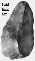
 The finds at Foxhall Road
proved to be of national importance; they
confirmed not only that there were humans in Ipswich in the
Palaeolithic period but that they enjoyed life on the plateau above the
Orwell valley. Nina also visited Trinity
Brickworks in Cavendish Street and the Dales brickfield hoping to
find similar objects but there were very few flints in these locations.
Her most significant discoveries were in Hadleigh Road in 1905, the
site of an Anglo Saxon cemetery (with 160 graves). She had excavated
the Hadleigh Road site with the help of men engaged by Ipswich Borough
Council on a ‘workfare scheme’ (opportunities for the unemployed) just
ahead of work beginning on a road widening scheme.
The finds at Foxhall Road
proved to be of national importance; they
confirmed not only that there were humans in Ipswich in the
Palaeolithic period but that they enjoyed life on the plateau above the
Orwell valley. Nina also visited Trinity
Brickworks in Cavendish Street and the Dales brickfield hoping to
find similar objects but there were very few flints in these locations.
Her most significant discoveries were in Hadleigh Road in 1905, the
site of an Anglo Saxon cemetery (with 160 graves). She had excavated
the Hadleigh Road site with the help of men engaged by Ipswich Borough
Council on a ‘workfare scheme’ (opportunities for the unemployed) just
ahead of work beginning on a road widening scheme.
Ipswich should have been recorded as a site of national importance but
the First World War denied Nina the recognition she deserved and later
she was upstaged by discoveries at Pakefield, Suffolk and Happisburgh
on the Norfolk coast (indicating humans have lived in East Anglia for
almost one million years).
In 1914 Valley brickworks was sold,
and in 1922 Bull Motors moved to the site. By 1968 factory space had
become available and this was occupied by Celestion Speakers. The
Celestion factory closed in the 1990s and Bull Motors moved to
Birmingham in 2000 thus the site again became available for human
occupation."
[§In
fact a well-known digital map provider shows and names the 'Mill River'
in Bixley Heath Nature Reserve as it enters Ipswich Golf Club; it is
soon joined by the 'Mill Stream' flowing south from the Foxhall Stadium
area, then on, growing in size it flows beneath the A12, through
Brightwell,
under Watermill Road at Newbourne to be joined by the stream that
visitors to Newbourne Springs Nature Reserve will know well, swelling
it in size before it eventually reaches the River Deben.]
In a way, the most surprising thing about John's article is that
a river in Ipswich flows 'the wrong way' – not down the surrounding
hills to the River Orwell, but the in the opposite direction to its
sister river. He sends this additional information
about the course of the Mill River:-
'The Mill River doesn't really flow the wrong way (as ageing
cyclists will know, the railway bridge on Foxhall Road is the high
point, down hill to the Orwell cycling west and downhill to Henslow
Road cycling east. The Mill River marks an ill-defined valley
from the pocket park Foxhall Road to Provan Court (off Bull Road) under
the railway, (the railway builders ensured it didn't flood the
Felixstowe Line) then into Malvern Close off Felixstowe Road.
Mill River originally crossed into Felixstowe Road at about The Haven
public house (where I assume it is still in a culvert) but then back
between the houses to the north (note how Margate Road drops down at
its eastern end). Under the railway again and into the pumping
station in front of the Children's Hospice (EACH Bixley Road).
Bungalows in Bucklesham Road have a very long front gardens, the Mill
River at this point was in a deep valley, the stream is now in a
culvert
and the valley filled (with Green Sand from Crane's Foundry).
The stream doesn't actually appear on the 1904 OS until the Gothic
Cottage on Bixley Heath from where its route is known (and visible);
the stream at the bridge on Bixley Heath can be surprisingly full after
heavy rain.'
Springs, conduits and a fresh water
supply to the
town
Springs
"Ipswich is fortunate that the River Gipping has carved its way down to
the Chalk – at about 85 million years old, the oldest and lowest of the
surface rocks here. It provides a stable foundation for the tall
buildings which line the Waterfront, for the Orwell Bridge and for our
new flood gates. It also supplies much of our modern water supply.
Younger London Clay (Eocene, 54 million years old) and Red Crag
(Pliocene, 2¾ million years old) sediments overlie the Chalk and
outcrop higher up in the valley sides. The permeable Red Crag holds
water, which gushes out as springs where it meets the impermeable
London Clay below. Thus Christchurch and Holywells Parks have a
constant and plentiful supply of natural water for their various lakes,
ponds and canals, issuing from the Red Crag/London Clay junction.
"Lining the river banks and sitting on top of the Chalk is a series of
gravel terraces. A gift of the Ice Age when torrents of melt water
flowed down the valley, these formed level, well-drained land for the
first Anglo-Saxon settlement here. It is no coincidence that Ipswich is
the oldest continuously settled town in England. It has, arguably, the
best settlement site in the country and the Anglo-Saxons, arriving here
in the early 7th century, recognised this and stayed, thus laying the
foundations of our town. Building their early settlement at the head of
the Orwell estuary, a navigable 15 kilometre inlet of the North Sea,
they chose the sunny, north bank, with its plentiful water supply from
the crag springs. The broad terraces and gentle slopes have provided
room for growth into the large town we have today, which still benefits
from its sheltered aspect." (Extract from Caroline Markham's article Foundations in The Ipswich
Society's book Ipswich: a town to be
proud of, 2019.)
A crucial aspect of human (particularly urban) habitation
is the availability of fresh water to the inhabitants. Given the
advantages of the clean springwater in the hills around the
Ipswich,
it was not too difficult to arrange pipework into the town centre.
However, the surplus water found its own courses down the bowl-shaped
terrain towards the town
centre and eventually into the River Orwell. Radial streets from the
town centre provided ideal water courses and one of the longest
journeys for spring water came from around the Cauldwell Hall estate
(marked today by Cauldwell Hall Road
and Cauldwell Avenue) on the east of the town which became the
Cauldwell Brook. Many early street names reflected the relationship to
water.
The Cauldwell Brook & The Wash
Spring Road did not really exist in the mid-18th century; it was known
as 'the old hollow way into Ipswich' and was gated at the foot of the
steep hill near today's St Johns
Road junction, becoming no more than a footpath uphill through meadows.
The upper section of today's Spring Road (roughly from the Cauldwell
Hall Road crossroads eastwards to Lattice Barn) was 'the Old Road'. The
water flowed down 'the old hollow way into Ipswich' and
pooled as it became St
Helens Street, called variously 'St Helens Wash' and 'Great Wash Lane'
in the past, such was the volume of water during rainy periods.
Additional water flowed down Water Lane (today's Warwick Road) carrying
flows from Albion Hill (Woodbridge Road). This
undrained area at the site of today's Grove Lane junction was
impassable by wheeled vehicles at this time. All traffic used 'The Way
to Woodbridge' (later Woodbridge Road) to leave the town and that way
would have taken them along today's Rushmere Road, the section to
Lattice Barn was yet to be built by the Turnpike Trust. [See our Barclays/tollhouse page for more on this.]
Our H.W. Turner page shows a
flooded St Helens Street in 1911 with shop staff armed with brooms to
try to sweep the waters away from their thresholds. Near to today's
Argyle Street was Wells Street
(commemorated by the 20th century Wells Court flats development),
again an indication of the dominance of water to the inhabitants. For
centuries in Ipswich there was little paving and no tarmacadam road
surfaces, so the water carved its way into the roadways and created mud
and pools of clay and liquid horse manure which cannot have aided
passage by said horse and cart
(which also churned up the roads, no doubt).
The
Spring Road waters continued past the present-day Argyle
Street/Grimwade Street
crossroads (Borough Road,
later Grimwade Street, originally
only ran as far north as Rope Walk – the prison yard was
beyond), past the Ipswich Gaol (behind County
Hall), to Major's Corner.
A sharp turn left into The Upper Wash and
Lower Wash (Upper and Lower Orwell Streets), having crossed the Spread
Eagle/Orwell Place crossroads where stepping-stones (stepples) were
installed to enable the poor pedestrians to cross without getting their
feet too wet or muddy; indeed Orwell Place was called 'Stepples Street'
at this
time. See Street name derivations for
more on these street names. The 'Common Wash' around Lower Orwell
Street was an area where people washed their clothes. Eventually all
this water pooled in the marshes above the northern quays of the dock,
eventually seeping into the Orwell. It seems that this would have been
the worst place to build a medieval church so the central one of the
three dockland churches, St Mary-At-Quay,
was duly constructed there and has suffered the structural consquences
ever since; in
2016 the building has been saved as a well-being centre and the walls
and stone columns repaired and cut off from the destructive rising
damp.
From leaving the 'Cauld Well' the water dropped about 180 feet to the
river.
Of course, at a time of little sanitation and open sewers in the
medieval streets of Ipswich, the inhabitants used the flowing water to
carry away horse and human filth and other waste. The spring
water, once so clean and clear, was anything but by the time it reached
the river. Even after
much of the spring water flow was piped underground in the
20th century (see the following paragraphs), it continues to trickle
from hillsides, for
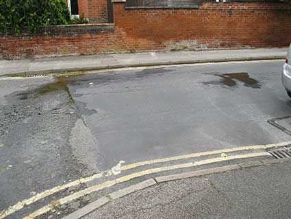
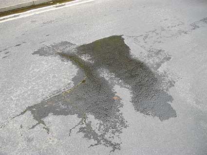
example in Grange Road and Alexandra Road (see images below), and the
lower-lying streets
of Ipswich experience flash flooding in extreme weather conditions.
Inhabitants of Spring Road have had their cellars flooded and they
really know that there is a deluge when the heavy cast iron drain
covers in the roadway are lifted up by the force of the water from the
overwhelmed underground pipes.
 2016 images
[UPDATE summer
2016: above – spring water flows in Alexandra Road,
close to the junction with
Warwick Road (formerly Water Lane). The main flow to the left partly
trickles
down the gutter drain, the rest moving over the road and some distance
down the gutter of Warwick Road. The cracks in the road surface yield
more water; all the wet areas are turning the road surface green.]
'It is recorded that in 1463, a ship sailed from Ipswich
with men and
stores for war. Amongst the stores were 8 ‘pipes of Caldewelle’,
containing fresh water brought from the springheads at Caldwell. As
early as the 15th century the Blackfriars
Priory were bringing the water in through wooden pipes as by the
time the spring water reached the town, it become more and more
polluted as domestic and trade waste was swept in to the water course.
The pipeline, the source of which was probably the
springs at Cauldwell Hall, was later to be utilized by the Corporation
for general consumption.' For a small fee, the town authorities allowed
the water to be extracted along the route but as Dr J. E. Taylor's
notes
in his description of ancient Ipswich in 1555 some one took the
entrepreneurial spirit a bit too far. Edmund Leeche, of St Margaret
Parish, seeing the water was so abundant, decided without prior
permission, to erect a water wheel upon the course of the Caldwell
Brook. By stopping the water, he flooded his neighbour's gardens. It
was ordered that “… the said Edmond shall take away his floud-gate and
and mill-wheel before Mich. [Michaelmas] next, under £20 pain, to be
levied upon his goods and chattels, and that no person shall henceforth
keep any watermill there for the grinding of corne”. This order was
treated either with contempt or neglect, for five months afterwards, it
is stated that “Edmund Leeche, not having taken the floud-gates and
mill-wheel upon the stream from Caldwell Brook, it's ordered that he
does so before Christide, under peril of £20 forfeiture and for the
fine already set upon him."
In their Golden Jubilee Booklet of St. John the Baptist Church produced
in 1949, Miss B. Hurley and Miss H.K. Garrett wrote of St Helens Street
in the 1850s, then known as Caldwell Street, as possessing a gaol and
two leper hopitals and of Spring Road as being well named as it was "…
but a sandy often swampy bridle path. As late as 1865 when young
residents of Cauldwell Hall were returning from Balls, the cabbies
refused to drive any further than the viaduct in Spring Road lest their
wheels stuck in the mud." During the late 19th and 20th centuries
rather than running down through the 'Wash' to the River Orwell, the
springs were piped in to a reservoir beside the railway viaduct on
Spring Road for distribution to the town. This reservoir was demolished
in 2007 and student accommodation built on the site' [Source – Gooding,
A: The history of Cowper Street,
Ipswich. See Reading list]
Christchurch Park. The level
rises by about 38 metres from the Soane Street entrance to the
northernmost Park Road entrance. In keeping with the bowl-shaped
topography of Ipswich, this results in plentiful spring water in the
park, as found elsewhere in Ipswich. The finest public park in the
town, running down almost to the town centre, is noted for its lush
vegetation and ponds. The latter – probably in different configurations
– probably date back to the fishponds of Holy Trinity Priory,
which stood on or near the site of today's Christchurch
Mansion, although the Round Pond may be 17th century. See our entry
for Dairy Lane on the Street name
derivations page for an insight into water management in the park.
Holywells Park ('Hollow
well') tells its own story of water in its name. We
include an early 1930s map of the park on our Bishops Hill page, showing all the bodies
of water including much of the moat around the Bishop's Palace – which
gives the hill its name. See below for an explanation of the so-called
'Holy well': C. Holywells.
Ipswich as a spa town?
With the pure spring water, plentiful throughout the history of
Ipswich, it has puzzled us that the town did not develop as a spa, as
did Felixstowe (the 'Spa Pavillion'). It has been suggested that
Ipswich was just too industrial
to attract the country gentry (in the same way that the wealthy and
Middling Classes gravitated towards Bath at the time Jane Austen was
writing her novels). In a maritime port town associated with
shipbuilding,
rope-making, brick and tile-making, tanning, phosphate manure
manufacture, staymaking (whalebone
corsets), heavy engineering, malting and brewing and so on, perhaps it
was just too trade for the
toffs. Here are some of the aqueous candidates...
A. St Georges Street
In the second half of the 17th century, a spring was discovered
on St
Georges Street. This would have been one of the many springs which
still surround the town; perhaps the location close to the town centre
and to the (now lost) Church of St George made it of some importance.
However, Ipswich already had a spa: the ‘Ipswich Spaw Waters’ in St
Margarets Green (see B). The idea of opening another spa was
rejected.
[This
text is repeated on our page on The Unicorn,
as it relates to 'taking the waters' and the development of a bottled
mineral water business, Talbot's.] The medicinal but
foul-tasting water of the spring found in St.
Georges Street in the late 1600s was never developed into anything, as
it could never have competed with the existing Ipswich Spa, a
sulphurated spring on St. Margarets Green.
B. St Margarets Green
A puff for 'Ipswich Spaw Waters' appeared
in the Ipswich Journal for
May 20-27, 1721; as the address was St Margarets Green, the source was
probably one of the Christchurch springs:-
‘IPSWICH SPAW WATERS
Experimentally found to be good in the gravel of the kidneys,
obstructions in the liver, spleen &c. Hectic fevers, the
scurvy,
violent vomiting, lost appetite, the jaundice, King’s-Evil, salt and
hot humours in blood, pains in stomach, frequent spitting of blood, or
bleeding at the nose, diarrhoea or blood fluxes. Sold at two
pence per
flask or quart, or each time of drinking what you will in the
morning.
By me, JONATHAN ELMER, living on St Margaret’s Green, Ipswich.’
Waters possibly from near this spring were advertised May 16-23
1724 in the Ipswich Journal ‘The
Ipswich Spaw Waters is now opened by Mrs Martha Coward, and
Attendance
will be given every Morning at the Bath on St Margaret’s Green, from 6
to 9 at One Penny per Morning, and Two Pence for each
Falk [presumably
‘Folk’] carried off.’
At the height of the Regency Spa craze, around 1814,
letters appeared in the East Anglian
Daily Times:
1) M.D. of Bury St Edmunds compares Ipswich springs to German Spa
waters and says they are better than German Spa or Tunbridge Wells if
drank at source (Georgians generally couldn’t bottle water as it went
off after 3-4 days from bacteria.)
2) H. Seekamp writes that Issac Brook, a cooper, discovered a
sunken, brick arched spring in St Georges Lane that he supposed was
mineral water as it had such a foul taste. Three Doctors
(including famous Dr Coyte) had the
water analysed and found it to be equal to the waters of Bath –
Medcalfe Russell of The Chantry had been recommended by his London
doctor to go to Bath to take the waters took this water instead and was
cured. Given the description of 'foul-tasting' waters of St Georges
Street, perhaps this second letter can be ascribed to exaggeration by
the yellow press.
C. Holywells
The reputed mineral springs with healing properties which poured
down Holywells Park was a myth created by the Cobbold brewing family.
The Cobbolds used to provide part of the town water supplies and used
the same Holywells
water from their estate as they used to brew their beer (beer-brewers
require hard water for the best beers – something resulting from the
Ipswich chalk beds); however, it
appears that this water
was plain, clean, crystal-clear, shallow spring water. Spa waters seem
to require quantities of iron (termed Chalybeate) and/or sulphur to
confer some tonic effect. It is not clear how the resultant Cobbold
beer would taste if it had been brewed from such mineral-rich water. Holywells
was not, as many believe, named after the 'Holy Well' of Holywells
Park which was frequented by pilgrims but after a 'Hollow well'. (However,
across the river, close to the Stoke area of Ipswich, there
certainly was a 'holy well', recorded as 'Haligwille' in a boundary
charter of AD 970; this spring was on a hillside at the former Fir Tree
Farm and may have been close to where the renowned hoard of golden Iron
Age torcs were discovered in 1968: Holcombe Crescent,
Belstead Brook.)
D. Dykes Alexander's estate
G.R. Clarke in his 1830 history of Ipswich (see Reading
List) mentions another spring that never froze in the
grounds of a cottage next to The Shears Pub on land belonging to
Dykes-Alexander fairly near to the other spring. Richard Dykes
Alexander’s house was at the former Bank on Barrack Corner, now
converted into flats (see our Blue Plaques
page). The water from this well was sent to London for analysis by Mr
Barry who stated that it contained iron sulphate, iron carbonate,
sulphurated hydrogen (from degrading pyrites) and he saw no reason why
this water and Ipswich spring waters with different properties could
not be rendered serviceable and bought into general use.
(The above is based
mainly on research by Adrian
Howlett.)
As we now know these enterprises did not thrive and it is, perhaps, a
tribute to Ipswich that such quackery and snake-oil seller's scams
failed in the town, where they were so profitable (but, no doubt,
ineffective) elsewhere. Cheers!
The eastern conduit
'[In 1615] the new pipeline was to be supplied from springs near
Cauldwell Hall, not far from the source of the Cauldwell Brook.
Topography and the street pattern ensured that the route of the
pipeline could hardly have been simpler. From the Cauldwell springs,
about 60ft above the level of the town centre, the pipe was laid almost
in a straight line, following the course of the Cauldwell Brook down
Spring Road and St Helen's Street (GreatWash Lane) to the junction with
Upper Orwell Street (The Wash) at Major's Corner, then along Carr
Street and Tavern Street to the Cornhill, a distanceof a little over a
mile.' (David Allen, see citation at the foot of this web page.) The
cistern in which the water was collected was housed in a lean-to
structure adjacent to the Old Town Hall (formerly St Mildred's Church)
on Cornhill with intermediate cisterns along the one mile length. An
interesting feat of water engineering. By 1848 nearly 1,500 homes were
taking this water from a couple of mains in Carr Street.
The
following excellent text by John Norman, Chair of the Ipswich Society,
formed the Ipswich Icons
column in the Ipswich Star
newspaper (16.6.2016) and it ranges from the influence of the monastic
houses on water supply to Thomas Cobbold's move to Ipswich in pursuit
of its sweet waters to brew his beer and on to the Ipswich Water Works
in, logically, today's Waterworks Street:-
"Monasteries and geology brought a fresh water first
"Ipswich was one of the first towns in the country to enjoy a piped
supply of clean fresh drinking water, initially to conduits (taps) in
the street but later directly into their homes. There were two
reasons why Ipswich was in at the beginning, firstly the monasteries had both the demand for and
the wherewithal to construct supply pipes and secondly Ipswich is
blessed with a natural water filtration system.
"The Augustinian Priory of St Peter and St Paul, founded in the late
12th century, was situated close to St
Peter's church in what is now
College Street. Residential
accommodation for dozens of monks
required a regular supply of drinking water. Traditionally the
monks would have carried it from a spring, a well or from a local
stream but here there was a natural supply oozing from Stoke Hill on
the other side of the river. A supply pipe was required.
This lead pipe started in the hillside below St Mary’s Stoke, crossed the river in
the shallows upstream of Stoke Bridge
and into the Priory. Evidence suggests it was in place by the
late fourteenth century. This supply later became a source
of water for the Stoke Waterworks Company (supplying St Peter’s parish).
 c.1795
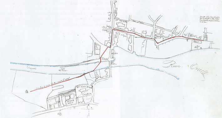
[Above: Isaac Johnson's sketch map of the main water pipe, shown in
red, from the water-house on land (Waterhouse Meadow) belonging to
Stoke Hall, c. 1795 – taken from Blatchly: Isaac Johnson, see Reading list. See our Stoke
Hall page for
another, more finished map of the Stoke Hall area by Johnson; you can
also read an 1819 sale notice description of the income derived from
sale of water to the town.]
"The Monks at Blackfriars almost certainly had a piped water supply
discharging into a fountain in the Garth, the garden on the middle of
the Cloisters. Evidence suggests the supply was from the
Cauldwell (Cold Well) estate on the hillside further east.
Although frowned upon by the monks it was the habit of parishioners to
tap into this pipe and insert quills (smaller pipes for their own
individual supply).
"In 1569 the Corporation acquired the buildings at Blackfriars to
establish a workhouse, a facility that became Christ’s Hospital, endorsed by
Letters Patent from Elizabeth I in 1572. Excavation at
Blackfriars have revealed that there was a feature in the Garth and it
sounds rather romantic to imagine this as a fountain, continuously
issuing fresh cold water for drinking, cooking and washing.
"There is no documentary or archaeological evidence of where the
Augustinian canons at Holy Trinity Priory (Christchurch
Mansion)
obtained their supply but there are multiple springs issuing from the
slopes of Christchurch Park. A conduit from one of these ran into
the town centre and terminated in a faucet at Conduit House on the
corner of Tavern and St Lawrence Street, (there is a plaque high up on
the building to mark the spot). [See our Ipswich Coat
of arms page for photographs of this.]
"The second reason Ipswich has an almost limitless supply of fresh
drinking water is the geology. In very simple terms Ipswich is
founded on chalk, overlaid with clay (London Crag) which, above the
sloping valley sides, is then overlaid with sand and gravel. Rain
water passes through the filtration level (the gravel) which naturally
removes detritus leaving clean water to emerge from the spring someway
down the slope. Very early on in the life of the town the water
was described as being “quite free from deposit, colourless, inodorous,
and with agreeable taste.” Thomas Cobbold had been taking
shipfuls of
Holywells water to his brewery in Harwich
(founded 1723) until he
realised that it would perhaps be more sensible to move the Cobbold
Brewery to
Ipswich (1746).
"Before the houses were built in Bolton Lane
there was a Water House
just inside the park, close to the Toll House controlling access to
Westerfield and Tuddenham Turnpike Roads. It consisted of a
single room with large tank, constantly supplied with fresh water from
an adjacent spring, the overflow from which ran down Bolton Lane and no
doubt [ended up] as the stream flowing along Upper and Lower Orwell
Street. This stream was difficult to cross in Orwell Place so
stepping stones were used and the area became the stepples or the
Wash.
"Cobbold, who had moved his brewery from
Harwich to Ipswich to be
adjacent to the wholesome water supply of Holywells sold the water to
some 600 householders, expanded this side of the business and
established an additional source of (ground) water north of St Clement's
Church in what was then Back Street (Edward White's map
1867). The
street later became Waterworks Street and the business was purchased by
the Corporation in 1892 to become the Ipswich Corporation Waterworks
(ICWW). There was debate as to whether they could also take
control of the Stoke Waterworks Company, by then owned by the Eastern
Counties Railway, which they did. In 1973 ICWW became part of
Anglian Water Authority, one of ten regional water management
companies. Anglian Water was privatised in 1989."
Waterworks
Ipswich Corporation Water Works played an important part in the public
health of Ipswich. Its story is told on our Street furniture page in relation to
cast iron 'ICWW' Hydrant covers set into the pavements. By the mid-19th
century, privately-owned reservoirs charged inhabitants for their water
supply including those owned by the Cobbolds' in Holywell, the
Alexanders' – the Quaker bankers – in St Matthew's and the Waterworks
Company in St Clement's. The town's 4,000 other
households relied on public pumps or their own wells, most of which
were contaminated. As wealthier people moved into homes on the higher
ground of the Fonnereau's northern suburb ('the big houses round the
park'), pressure increased for better supplies and money, as it so
often does (many members of the Council had moved there themselves),
talked and the Waterworks Company built a reservoir in Park Road, but
it was soon too small – see our Coat of arms
page for a feature there bearing the Borough crest. The Council bought
the company in 1892 and
hastened to review and improve water provision. Water hydrants were
placed at strategic points; it was calculated that the consequent rise
in rates would soon be recouped by householders by the lower fire
insurance premiums. By 1900 virtually every one of the town's 14,000
households had running water.
Thurleston Lane pumping station
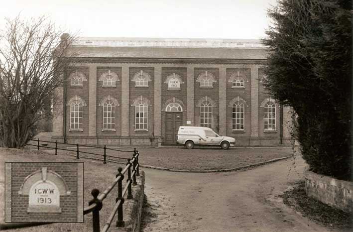 1990
image, Courtesy
Ipswich Society
1990
image, Courtesy
Ipswich Society
The central panel above the door reads:
'ICWW
1913'
The above 1990s photograph by Tom Gondris can be found on the
Ipswich Society's Image Archive (see Links). The pumping station lies
in a dip in the surrounding land to the north of the Whitton housing
estate and close to Akenham Church – on of the most remote churches in
the county.
'Whitton Water Pumping Station, Thurleston Lane, 1913. Formerly Ipswich
Corporation Waterworks. Single storey building. Red brick with Suffolk
white brick features. Clay tile roof. Clerestory roof light. Brick
dentilled eaves. 7 window range, multi-light iron framed windows with
brick arch and keystone heads. Windows set in red brick panels with
white brick piers. Circular windows in gable ends. Panelled double
central door with arched brick head and fanlight. Stone capping to
gable ends, corbelled at eaves.' (Ipswich Borough
Council's Local list SPD – see Links)
[UPDATE 4.12.2020: 'I've
just followed the link on facebook to the section about the water
supply. I live in Anglesea Road and a lot of the old sales particulars
for the houses here state that all the pipework, cisterns and W.C.s are
the property of the Broke Hall
Waterworks and do not form part of the fixtures and fittings.
Was this usual? And would they have repossessed them if the residents
didn't pay their bills? Thanks for the website. I always land up
spending ages on it clicking on various links.' - from a browser of
this website. Thanks for this
contribution concerning a waterworks about which we had no knowledge.
The Mill River (‘the lost river’ described in its own passage further
up this web-page) which once ran from Foxgrove on Foxhall Road all the
way to the golf course near the Broke Hall housing estate and on to
join the Deben shows that water was a feature in the eastern outskirts
of the town. Any more information about the Broke Hall Waterworks and
this practice of retaining ownership of water fixtures and fitting
would be welcome.]
Sewerage and Sewage
Sewerage is the
infrastructure that conveys sewage
(human waste and waste water from a variety of sources) or surface
runoff (stormwater, meltwater, rainwater) using sewers. The words
'sewage' and 'sewer' came from Old French essouier (to drain), which came
from Latin exaquāre.
Concomitant to the improvement in water supplies was the crying
need for adequate sewage provision. It is worth recalling the
uncomfortable fact that, in the past, many households stored their
human ordure in
tanks and sold it to the Night Soil Man to be sold on to farmers for
manuring their fields. Imagine one of the tightly-built courts or yards and the fact that an average
human might produce five hundredweight of solid waste in a year; no
wonder Ipswich town was odiferous. Worse still, building sewers not
only increased the rates, but resulted in loss of income. Not just to
individuals, but to importers of London's sewage which arrived in boats
at Ipswich docks for distribution around Suffolk for improving crop
growth. Perhaps when Suffolk people run down Ipswich there is a folk
memory of a time when it was an inlet for Londoners' faeces.
For many years the open sewer was commonplace: a central gutter in a
dirt road into which residents poured the contents of their chamber
pots and much else. If they were fortunate, the gutter would be flushed
down with spring water moving towards the river. Another method of
disposal was the dunghill; the area now bordered by Upper Orwell
Street, Bond Street and Eagle Street bore the name 'Cold
Dunghill'. Cold Dunghill was a street listed in the 1851 census
enumerators' books defining an area outside the town ramparts Later,
the town's shallow and inadequate sewers once discharged into the River
Orwell at Common Quay. This outlet was moved south of the gasworks on
the east
bank when the Wet Dock was built in 1842. Peter Schuyler Bruff, the
famous railway engineer responsible for the EUR
railway tunnel through Stoke Hill, was asked to design an improved
sewage system in 1857. It was not until 1881-2 that, with
modifications,
this system was built because of the authorities baulking at the cost.
Bruff's low-level sewage system through the heart of the town
eventually reached outlet tanks and a treatment plant a mile
downstream at Hog Highland (now part of Cliff Quay) on the Greenwich
Farmland. Ironically this had been a favoured picnicking spot, visible
to those taking a Sunday stroll on the leafy Promenade on the Island. The final cost of sewer-building was
£60,000.
Here is the text of John Norman's Ipswich
Icons column in the local press (2.10.2016), reproduced by
permission:-
"Project Orwell
brought much-needed
sewerage relief to the town
This week’s article is written under a false premise. I very much doubt
if you have ever seen this ‘icon’ and you almost certainly never will,
but it is an essential bit of kit contributing quietly to the
well-being of Ipswich, writes John Norman, of The Ipswich Society.
Ipswich was late introducing public sewers and although Peter Bruff (of
Eastern Union Railway fame) was commissioned to
design a drainage
system in 1857 it wasn’t until 1882 that the low level trunk sewer was
constructed. The reference to ‘low level’ implies across the lower part
of the town centre, Bramford Road to the Wet Dock and on to Pipers Vale
(the site of the present day water treatment works).
In 1927 civil engineer Edward McLaunchan designed a modern sewage
system and treatment works (completed in 1932). A key component was the
high level sewer which ran from Norwich Road through the town centre
and then across the Suffolk College site to the new sewage works.
McLaunchan promoted a scheme with a final outlet into the Orwell that
would not leave solids on the river bed or cause offensive odour. It
proved to be a very efficient system, but it wasn’t designed for, and
couldn’t cope with, sudden surges caused by heavy downpours. In such
conditions the system simply overflowed, into the Orwell, into the
Gipping, and occasionally into the street.
By the end of the 20th Century the town’s sewers couldn’t cope in times
of heavy rain. They were perfectly adequate for the everyday sewage but
because Ipswich has a combined system (both rain water and foul
discharge into the same drain) when a major storm deposited substantial
quantities of water in a short time the sewers overflowed, and the mix
of rain water and sewage spilled into gardens and low lying areas.
In the 1990s a European Urban Wastewater Treatment Directive instructed
all water authorities to make changes to stop this happening. In
Ipswich the solution was Project Orwell, a deep level large diameter
sewer from Bramford Lane allotments along the line of Norwich Road,
Anglesea Road, under Christchurch Park and then sweeping a slow curve
to Alexandra Park and Duke Street to Toller Road.
All of the major sewers the new tunnel passed under were allowed to
overflow into it thus in times of great storm the new tunnel simply
held a vast quantity of water until the storm had passed, water that
was then pumped (usually overnight) to the treatment works.
Project Orwell started in January 1998 with a large round hole, a
vertical shaft on a site adjacent to Toller Road. A tunnel boring
machine or TBM, affectionately named Athena by the guys on site, was
lowered into the hole and slowly but surely dug her way the 5km to the
west side of town. She drilled a 2.5m diameter hole through soft chalk
some 20 metres down, pulverised the chalk with the lubricating water
and pumped the resulting slurry back along the tunnel. This was then
carted away for use as an acid neutraliser on local farmland.
Athena was followed along the bore by a railway line, an ever-
increasing length of single track which was used to deliver tunnel
linings, additional track and men to the workface. The narrow gauge
railway didn’t last long; as soon as the TBM reached its destination
the track laying process reversed and all signs of the railway were
removed leaving a smooth bore, clean-lined tunnel with nothing to
hinder the flow of water.
In addition to the tunnel six vertical shafts were constructed to act
as additional storage capacity, each has a vent about the size of a
lamp post which is the only visible sign of the vast construction
project below the surface.
Civil engineers Amec completed Project Orwell in March 2000, in total
it had cost Anglian Water £33 million but had provided relief from the
unpleasant flooding that some residents had increasingly suffered."
Evidence of Project Orwell can still be found in the town. Here is
John's photograph of a corner of Alexandra
Park near to the bend of Milner Street and Kings Avenue (with
Suffolk New College in the background). In the foreground one can see
the Project Orwell cover over the access shaft to the
tunnel; the accompanying vent pipe rises behind it.
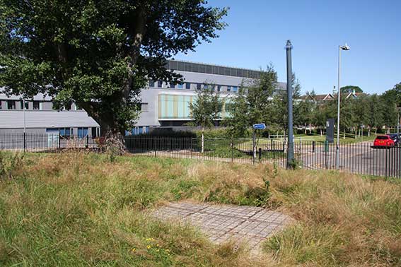 Image courtesy
John Norman
Image courtesy
John Norman
Further
reading – David Allen: The public water supply of Ipswich before
the Municipal Corporations Act of 1835. Suffolk Institute of
Archaeology and History,
2014.
Bathing places
[should we have
placed this section
somewhere other than after 'Sewage'? -Ed. Given the situation in 2026,
perhaps it was prescient. -A. Browser]
The construction of the Wet Dock in the late 1830s also caused the
closure of the town's bathing establishments: that in St Clement's run
by John Barnard, a second (which was only a few years old and featured
hot salt water, vapour and shower baths0 next to St Mary-At-The Quay and the third in Over
Stoke, off Wherstead Road. All three were replaced by another Stoke Bathing Place run by the
Corporation. Some will recall – and many will
have heard of – this Stoke Bathing Place which was 100 yards long and
was situated close to the bottom of New Cut, today the site of a
sophisticated anti-flood barrier. It was defined by straight barriers
dividing it from the wide river basin and was refreshed by tidal
waters. Swimming here was spartan or invigorating depending on your
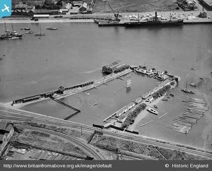
viewpoint. Here is an aerial view of Stoke Bathing
Place in 1930 from the remarkable Britain
From Above collection (see 'Special subject areas' in Links). Note that the Griffin Wharf branch line
curves in from bottom centre. The Stoke Bathing Place was removed in
the early 1970s before the building of the West Bank container terminal.
 1930
aerial view
1930
aerial view
See our St Helens Street page for a
similar aerial view of West End
Bathing Place on the Gipping at the end of Constantine Road. It
closed in 1936 due to pollution from the river.
Piper’s Vale Pools
were on the east bank of the River Orwell, they opened in 1937 close to
where the Orwell Bridge is now. The site was
demolished in 1979 as part of temporary road works through the area –
presumably for the construction of the Orwell Bridge from 1979 to 1982.
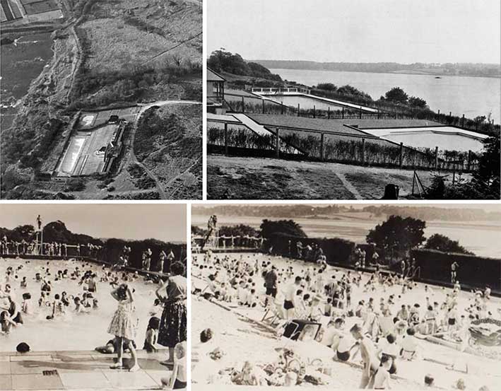 Images found on social media
Above: a
visitor to Ipswich Historic Lettering in 2026 sent these photographs of
Pipers Vale Pools. The upper aerial view shows the two pools and the
extent of the buildings. Upper right:
shows the proximity to the wide River Orwell. Lower images are
evocative of the 1950s and early 1960s with a large number of swimmers
and sunbathers. The 150 foot long pool was was intended as the
replacement for The West End Bathing Place, mentioned above. The
building of Pipers Vale Pool on the eastern edge of the town also
prompted the construction of another pool to serve the western side of
the town: this was Broomhill Lido, mentioned below.
Fore Street Baths
, one of the earliest such public swimming pools in the country,
continues to provide bathing facilities in Ipswich, particularly for
clubs and schools.
St Matthews Baths, Civic Drive,
opened in 1924 and closed in 1984, after
Crown Pools opened in Crown Street. This roofed site was open for
swimming in
the summer and the bath was boarded over and used as an events venue in
the winter months, playing host to many groups including a young Led
Zeppelin, Cream, Rod Stewart, The Move, The Who, Deep Purple, John
Mayall and the Bluesbreakers, Staus Quo, Fleetwood Mac, Jethro Tull and
The Spencer Davis Group.
Broomhill Pool
on Sherrington Road, next-door to the public branch library; it was Listed Grade II in 2001. It was built in
1938 at a cost of £17,000 and has been closed since 2002. A campaign
by the Broomhill Pool Trust
has been running since then to reopen the site. At fiteen feet, the
pool is the deepest lido in Britain. It is 55 by 20 yards in size. Broomhill Pool is a founding member of Historic Pools of
Britain: 'Established in 2015, Historic
Pools of Britain is the first body ever to represent historic
swimming pools in this country (it also includes an entry for Fore Street Pool). These unique indoor and
outdoor pools make a significant contribution to the social and
architectural history of Britain and play a hugely important role in
our communities.'
See our Ipswich in 1912 PDF for
photographs of bathing places on pages 31-33.
Does Ipswich 'own' the River Orwell?
It would be remiss of us to ignore a sore point of the town's
governance over its river as it flows to the sea. This takes us back
into centuries of history and a continuing feud.
"More intractable was the threat to Ipswich's commerce from Harwich,
situated at the very mouth of the Orwell. In the 1270s Harwich was
receiving assistance from its lord, the earl of Norfolk, who had
blocked the river with a weir, in order to divert to Harwich ships
bound for Ipswich. (Ipswich, on the other hand, had no great lord below
the king, nor serious commercial rival, despite its competition with
Harwich for control of Orwell haven; its history is therefore
comparatively quiet.) In 1340 an inquisition concluded that the port of
Orwell (itself possibly an urbanizing settlement which ultimately
failed to preserve an independent identity), and the estuary leading to
Ipswich were within the (admiralty) jurisdiction of Ipswich, and that
it was the Ipswich authorities – not those of Harwich – who could
collect tolls at Orwell port. In 1378-79, Ipswich and Harwich were
again in contest, over a location in Orwell Haven called Polles Head,
which an inquisition decided should be considered part of the port of
Ipswich." (from the website History
of medieval Ipswich; see Links)
Robert Malster in his
book A history of Ipswich
(2000; see Reading list) summarises the
issue:-
"In 1338 and 1339 Edward III spent a considerable time at Walton Manor
assembling his fleet in the rivers Deben and Orwell for the attack on
France. Walton Manor was a handy base from which to plan and carry out
such an operation, for on one side was the Orwell anchorage and on the
other the port of Goseford, centred on the 'Goose-ford' across the
King's Fleet, a creek off the Deben, which privided a link between
Walton Castle and Falkenham and Kirton.
"It was while Edward was at Walton that he mistakenly granted
jurisdiction over the haven to the town of Harwich, provoking an
immediate appeal by the burgesses of Ipswich, who pointed out to him
that
'the whole haven of Erewell in the arme of the sea there to the said
Towne of Ipswich dothe belong, and from all times passed hathe
belonged'. If not the beginning, it was the continuation of a rivalry
between the two towns that soured relations between them for centuries.
In an attempt to convince the king of his error, the burgesses of
Ipswich averred that because of the interferance of the Harwich men
they were preventing the fee farm, the sum of money that they paid to
the Crown each year." [Edward soon revoked his grant to the 'bailiffs
and men of Herewicz'.] ...
"Nearer to home the disputes between Ipswich and Harwich rumbled on. In
1379 Ipswich petitioned Richard III that they might have the haven to
Poll Head, a point seaward of Landguard Point 'wch they have
time out of memory belonging to them', officially and clearly assigned
to the town. The 13-year-old king gave directions for an inquiry to be
held, and at an inquest held at Shotley on 3 November 1379 a dozen
witnesses declared under oath that the port of Ipswich extended
downriver to the Poll Head, 'and so hathe donne time out of minde, and
remaineth so...'

"The town of Ipswich had gained jurisdiction over this muddy river
initially as a result of King John's charter [1200]. Succeeding
monarchs confirmed the charter and extended the privileges enjoyed by
the citizens, Henry VIII more particularly stressing the maritime
nature of the town by specifically confirming the Corporation's
jurisdiction over the Orwell. He granted the Corporation admiralty
jurisdiction: 'The Bailives of the said Town, for the Time Being, shall
be our Admirals, and the Admirals of our Heirs, for and within the
whole Town, Precincts, Suburbs, Water, and Course of Water."
In December 2019, Andy Parker of the Ipswich Maritime Trust gave one of
their talks on Henry VIII and the
ownership of the Orwell. Post-1066, the Bigod family ensured
that Dunwich, between Aldeburgh and Southwold, was the main port of the
county. With the decline of Dunwich as a major port, Ipswich became
dominant culminating in the award of its charter in 1200. This
established the Ipswich Corporation – effectively its Portmen, Bailiffs
etc. (some 64 men in all) – acting to control trade on behalf of the
Crown. The docks were the economic heart of the town and the basis of
its prosperity. At its peak over 60% of the country's wool exports went
through Ipswich, with finished goods and wine from the Rhineland coming
in. The power of the town probably reached its peak in 1519 with the
grant of the Patent of Henry VIII(§). This gave the
Corporation 'jurisdiction of admiral' within the town, as mentioned
above. The town's Bailiffs and Burgesses now had the right to make and
alter ordinances governing trade. Their jusidiction was said to extend
five miles north to south and four miles east to west. The grant
included the Orwell from high water mark down to a point now marked by
a stone on the southern bank just upstream from Shotley marina. Recent
speculation has focussed on the precise location of the marker-stone on
the bank of the Orwell, or the location of 'Poll Head' (or 'Polles
Head').
(§) It is, perhaps, unlikely that Ipswich would have
benefitted in this way without the intercession of Henry's Lord
Chancellor, Thomas Wolsey. The Patent was signed at Hampton Court,
which was Wolsey's palace, not Henry's (although he seized it later).
Wolsey, of course, had considerable interest in his home town including
the planned founding of Wolsey's College.
The Shrine of Our Lady of Grace, promoted
by Wolsey, was then second only in popularity to Walsingham in Norfolk
as a destination of pilgrimage. However, with Wolsey's fall from power
in 1529-30, the steady rise of Ipswich came to an end.
The intriguing possibility persists that Ipswich, in theory at least,
legally holds jurisdiction over the Orwell all the way down to
Landguard, where the river enters the sea. The early history of
Felixstowe, including its Roman, Anglo-Saxon, Norman and medieval
defences, is told under the name of Walton. The tiny scattered
settlement of 'Felixstowe' barely existed until the 19th century, but
today it includes one of the biggest privately-owned docks in the
country. Is the huge Port of Felixstowe built on an Ipswich possession?
Who has the time, skills and, above all, money to take this matter to a
long complicated court case? With the rapid economic growth of
Felixstowe, it must at some time have been suggested within Ipswich
Corporation (later Borough Council) that they should renew their legal
claim to jurisdiction over the river and banks of the Orwell down to
and including Orwell Haven. Potentially, the growing port would have
provided a substantial income to Ipswich, so they must have been
tempted. The decision-point was probably missed with worries about a
potential Bleak House-style
endless legal wrangle.
The river path
The Gipping Valley River Path includes the section starting from the industrial
dockland at Stoke Bridge through wooded
areas, dual cariageway fly-overs to quiet backwaters. It features
include old watermills and navigation locks. The 17 mile river path
through the western evirons of Ipswich, through Sproughton, Bramford,
Needham Market and Stowmarket. In 1793 200 men built 15 locks along the
River Gipping. These improvements allowed barges to travel the 17 miles
from Ipswich, and industries in Stowmarket developed rapidly. The
Gipping Valley River Path follows the route of the old tow path once
used for horses drawing the narrow boats. Today it is
difficult to imagine some sections of the river as being navigable, not
to mention some parts of the tow-path being suitable for a heavy horse as nature and flooding has
reclaimed and reshaped some areas. But
it's still a beautiful and varied walk.
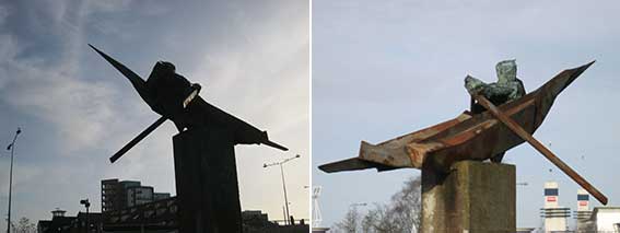 2016
images
2016
images
Against the tide
by Laurence Edwards (2004)
is a public
sculpture on the west side of Bridge Street, depicting a rower
struggling against waves and currents. It is mounted on a tall pedestal
which bears the words 'river path'.
Sarsen stones
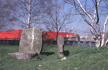 Photograph courtesy The Ipswich Society
The Sarsen stones stand close
to the Skatepark, west of Stoke Bridge and were arranged by local
artist Bernard Reynolds. These stones originate from sedimentary rock
laid down about 60 million years ago and were dug from the river in the
1970s when the flood defences were built. They are so hard that they
impeded
the driving of steel piling. They are silica-cemented sandstone from
the sands between the London Clay and the Chalk, and show a
well-developed mammilated (curved bumps) surface. Unfortunately the
stones are
much abused by spray-paint and worse. Above: some of the stones in the
1980s in a view from the Ipswich Society Image Archive (see Links) with railway sidings and the
Commercial Road – now Grafton Road – branch of B&Q store (now
closed) in the
background.
The Navigator
(2003)
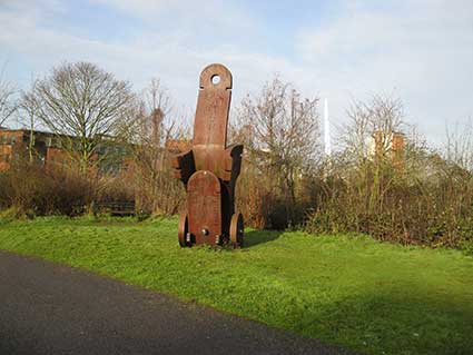 2016 images
Above right, intaglio numerals and chacters on the side section:
'1087BKLIN
DP1087LN
12'
John
Atkin was commissioned to make this sculpture for Ipswich, alongside
the River Orwell, by The Ipswich Society and The Ipswich River Action
Group. Inspired by the town's maritime history and industrial past,
influences were found amongst a variety of sources, from 19th century
stern castings for ships, navigational instruments, to pattern
templates, the 'wheels' of industry and human anatomy. It features a
variety of cameo and intaglio lettering including the artist's name and
date near the spike at the rear of the sculpture. This work was
constructed in Cor-Ten steel, a material that is synonymous with the
area's past industrial use; the layer of rust protects the structure
from further corrosion. There are also elements in
polished steel. It stands 16 feet high alongside the
river,
adjacent to a cycle path.
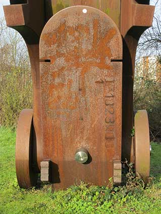
Above left: 'DP1823WBD 1'. Above right: 'J Atkin 03'. Below, on each
wheel in raised characters: 'ATK 03' (i.e. John Atkin 2003').
John
Atkin was commissioned to make this sculpture for Ipswich, alongside
the River Orwell, by The Ipswich Society and The Ipswich River Action
Group. Inspired by the town's maritime history and industrial past,
influences were found amongst a variety of sources, from 19th century
stern castings for ships, navigational instruments, to pattern
templates, the 'wheels' of industry and human anatomy. It features a
variety of cameo and intaglio lettering including the artist's name and
date near the spike at the rear of the sculpture. This work was
constructed in Corten steel, a material that is synonymous with the
area's past industrial use; the layer of rust protects the structure
from further corrosion. It stands 16 feet high alongside the river,
adjacent to a cycle path.
See also our Lettered
castings index page.
The Orwell and the dock tramway
From the site of The Navigator,
it is only a few yards to the rail bridge which once carried the dock
tramway over the River Orwell from a spur on the main line and down to
a level crossing on Ranelagh Road. One of the new developments on
Ranelagh Road is the Penta Hotel, which is built right up to the
tramway trackbed. Viewed from close to the sculpture, we noticed that a
railway signal was still in position, even though the level crossing
and its gates are long gone. Part of the metal bridge
can be seen at lower right in the photograph below right.
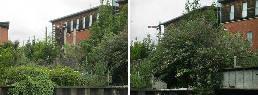 2015 images
Below: the view from Ranelagh Road – and the railway signal can
clearly be seen, even though this doesn't look much like a level
crossing any more.
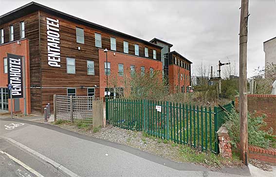
Below: an aerial view of this part of the Orwell from a photograph
taken by Brian Mateer from the Ipswich Society's Image Archive (see Links). The main line runs downwards from left
to right of the photograph; the Upper goods yard is in the upper right
corner. From there the spur leaves, crosses Ranelagh Road, runs over
the bridge and snakes around above, but next to, the river; both pass
beneath the Princes Road bridge. The
Navigator does not appear to have been installed at this time,
so the photograph must have been taken between 2000 to 2002. West End
Road can
be seen at the upper right and Ipswich station dominates the
centre of the picture.
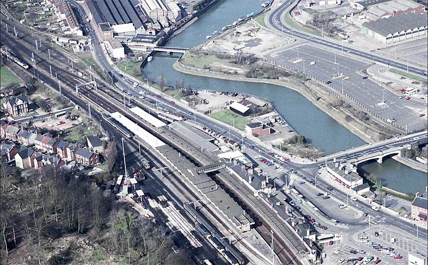 Courtesy
The Ipswich Society
Courtesy
The Ipswich Society
Also close to The Navigator...
The Old Cattle Yard
 Hosing out
the cattle trucks at the riverside rail head.
Hosing out
the cattle trucks at the riverside rail head.
The area
around The Navigator sculpture was, perhaps surprisingly, a cattle yard
from around 1880 until the 1950s. The yard handled livestock on the way
to or from the Portman Road Cattle Market. Although overgrown, you can
still see the remains of the brick flooring of the yard and cattle
pens, fencing and gates. The spur line from the Great Eastern Railway
main line, built in 1848, crossed Ranelagh Road and the river before a
turn alongside the river and the cattle pens, presumably the cattle
trains were halted here to load and unload livestock. There are stories
of a herdsman who used to sleep in a disused railway carriage near the
animal pens in case any animals arrived by a late train (apparently you
can still see the remains of the railway carriage chassis near the
Princes Street bridge). "As a junior school boy in the 1940s, just
after World War Two, I walked to and from my home in Ranelagh Road, to
St. Matthew's School, which was in the now disappeared St. Matthew's
Church Lane. I was always rather apprehensive on Tuesdays, as that was
the day when cattle were driven from a rail head near Princes Street
bridge, along Princes Street, and into Portman Road." [From the Kindred Spirit website, see Links.]
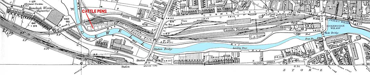
1902 map detail
The 1902 map shows the complexity of the railway and
tramway system revolving around the River Orwell. The single track line
comes off the Upper Goods Yard (next to the main line, show at the
left), runs over a level crossing on Ranelagh Road, over the river and
where the cattle trucks would have been shunted forward – past the site
of today's The Navigator sculpture
(shown above) – then back into short sidings for unloading (and hosing
out,
as shown in the photograph above). One or two little
features are seen on the river's edge:
'Landing Stage' at the rear of the Burrell Road houses;
'Boat Ho.' (boat house close to the river wall of a 'P.H.' (public
house next to Stoke Bridge);
'STOKEBRIDGE WHARF' which appears to relate to the north-south depth of
St Peter's Dock – the lagoon to the east of Stoke
Bridge. Today we know this as the 'Viewing
platform' and site of the Trinity House buoy.
On the north bank, 'Sl.' stands for sluice which indicates the
point where the underground Little Gipping River enters the Orwell (see
above under 'Little Gipping & Great
Gipping
Streets').
Useful Ipswich Borough Council maps
These can be found on the Ipswich Borough Council website.
 Major
watercourses in Ipswich map
(2011 map)
Major
watercourses in Ipswich map
(2011 map)
 Local
flooding in Ipswich map (2011 map)
Local
flooding in Ipswich map (2011 map)
 Trunk sewers in Ipswich map (2020
map)
Trunk sewers in Ipswich map (2020
map)
PLEASE NOTE: these maps were found on the Borough's website at
the time of updating this web-page (September 2023). However, such
features can be moved/replaced on the council's website, so may be a
challenge to track down.
See also the Suffolk Mills Group document on Windmills
in the Borough of Ipswich
(click to open the PDF).
The Gipping Valley
River Path
To give a flavour of the Gipping Valley River Path,
here are some photographs of Baylham Mill on Mill Lane, just north-west
of Great Blakenham. Crossing the
Ipswich-to-Norwich railway line past the mill and and
over River Gipping, Baylham
Rare Breeds Centre lies at the end. The main mill building is 18th
century, but parts of the mill house are much older. The mill is the
last on the River Gipping to retain its machinery, plus five pairs of
millstones. Baylham Mill ceased working in the 1970s but all the
machinery still sits inside, quietly rusting away.
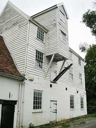
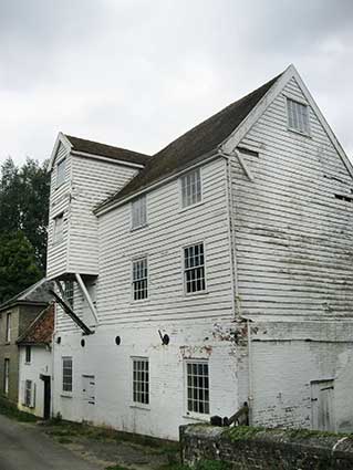 2018 images
Below: remarkable carved timber heads above the doorway into the
mill house; the weathering of the wood and spiders' webs just add to
the Gothic splendour of these faces.
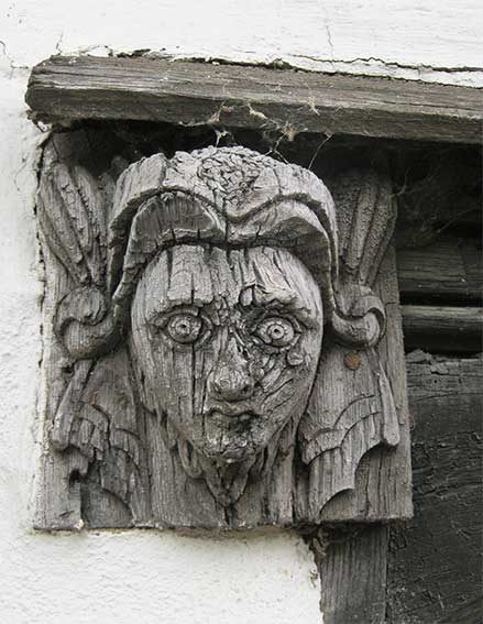
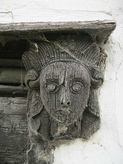
Below: the view in each direction from the mill bridge, sluices
and other structures related to the mill water-management are evident.
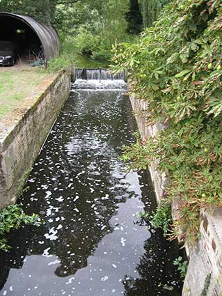
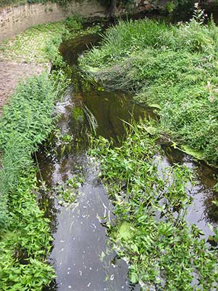
Home
Please email any comments and contributions by clicking here.
Search Ipswich
Historic Lettering
©2004 Copyright throughout
the Ipswich Historic Lettering site: Borin Van Loon
No reproduction of text or images without express written permission