 2000 image
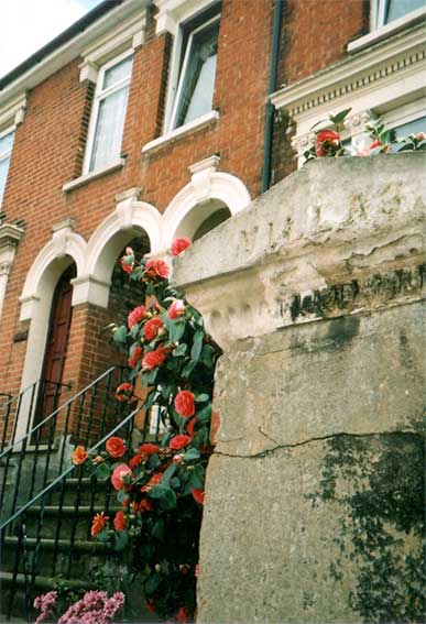 2004
image
2004
image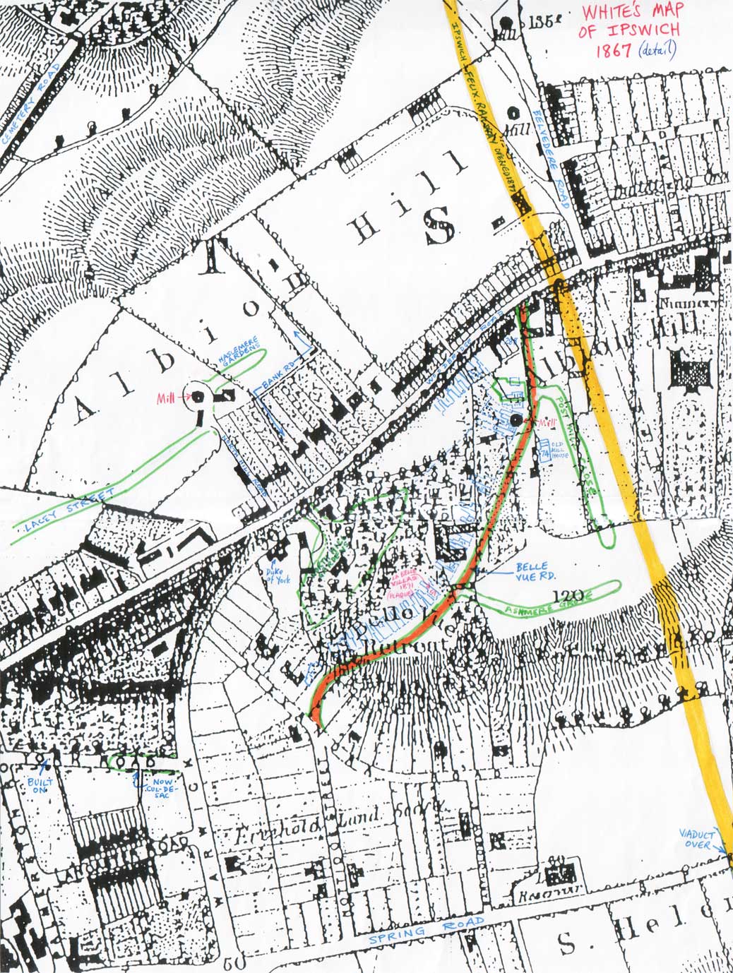
 2014
images
2014
images
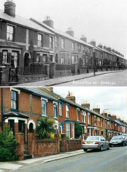
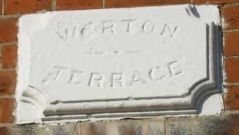
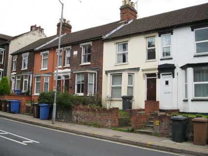
107-109: Warton
Terrace
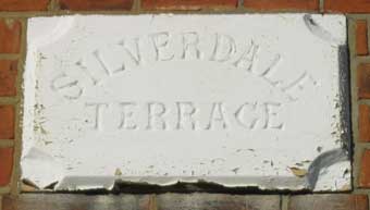
99-101: Silverdale Terrace
(Silverdale is a village within the City of Lancaster in Lancs.)
(Silverdale is a village within the City of Lancaster in Lancs.)
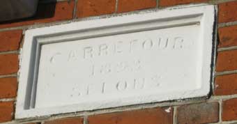
91: Carrefour - 1893 -
Selous
(Carrefour Selous is a village on the island of Jersey)
(Carrefour Selous is a village on the island of Jersey)
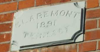
79-81: Claremont - 1891 -
Terrace
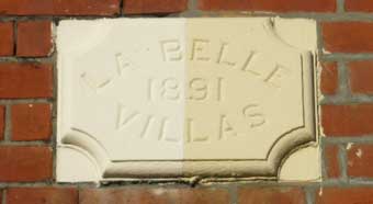
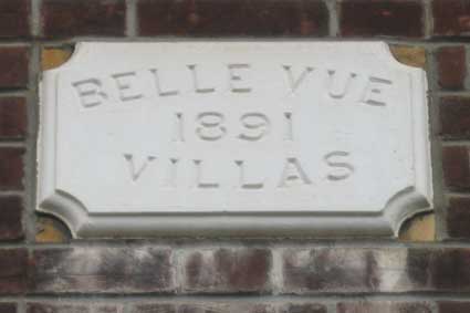
55-57: La Belle - 1891 -
Villas
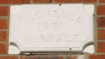
43-45: Florence - 1891 -
Terrace
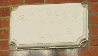
31-33: Byculla - 1893 -
Villas
(Byculla is a neighbourhood in South Mumbai, [Bombay].)
(Byculla is a neighbourhood in South Mumbai, [Bombay].)
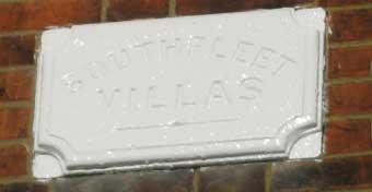
27-29: Southfleet Villas
(Southfleet is a small village in the borough of Dartford.)
(Southfleet is a small village in the borough of Dartford.)
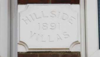
6-8: Hillside - 1891 -
Villas
(Between two windows. Well-named.)
(Between two windows. Well-named.)
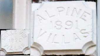
14-16: Alpine - 1891 -
Villas [inset- 18-20: Belle Vue - 1890 - Villas] (Plaque
squeezed
between two windows.)
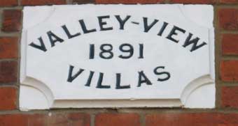
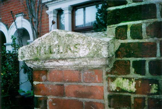
22-24: Valley-View - 1891
- Villas
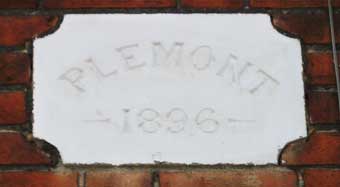
30: Plemont - 1896
(Plemont is a headland in north Jersey.)
(Plemont is a headland in north Jersey.)
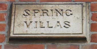
Spring Villas (4-6
Ashmere Grove)
(Overlooking Spring Road valley and, of course, the natural springs hereabouts, still seen in Alexandra Road below.)
(Overlooking Spring Road valley and, of course, the natural springs hereabouts, still seen in Alexandra Road below.)
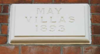
40: May Villas - 1893
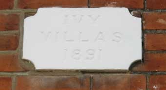
50-52: Ivy Villas - 1891
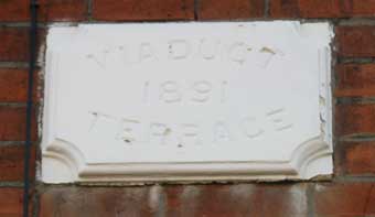
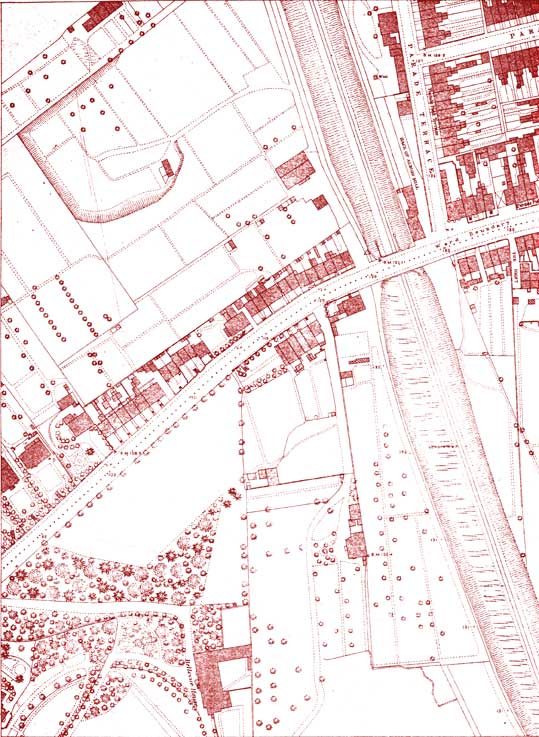
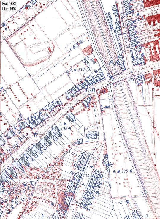
58-60: Viaduct - 1891 -
Terrace
(The Felixstowe Line railway behind these houses approaches the viaduct over Spring Road.)
(The Felixstowe Line railway behind these houses approaches the viaduct over Spring Road.)
70: Nankin Villa*
(Nankin is the capital of Jiangsu province in Eastern China)
(Nankin is the capital of Jiangsu province in Eastern China)
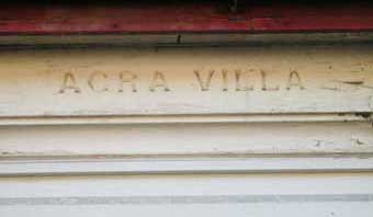
72: Agra Villa*
(Agra is a city in the northern state of Uttar Pradesh, India.)
(Agra is a city in the northern state of Uttar Pradesh, India.)